Gary Dale Mawyer
  • Home
  • Blog
  • DARK
  • Exemptions
  • MACAQUE
  • Rockfish
  • Sergeant Wolinski
  • SOUTHERN SKYLARK

VISITING AMERICA Part 4: ANARCHY IN BANNACK

9/21/2021

1 Comment

 
In 1862, a group of disappointed gold miners roaming through southwest Montana stopped to pan Willets Creek (as named by Lewis and Clark). The miners called it Grasshopper Creek. They struck gold, and it was one of the big strikes that reverberated with a thrill all the way across the continent. The first lucky miners wanted to keep it secret, but as more and more fine gold turned up, desperate and heavily armed men showed up by the thousands. Thus Bannack was founded as Montana’s first capital city. The shootin’ and buryin’ started immediately.
Picture

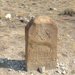
Early resident of Boot Hill, Bannack MT.
Picture
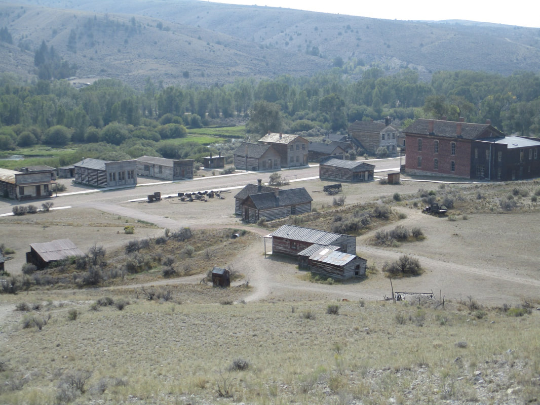
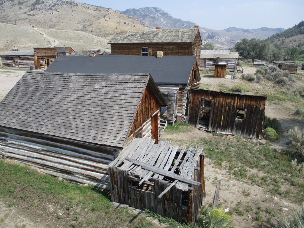
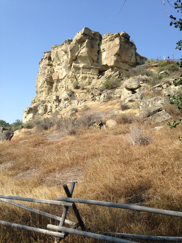
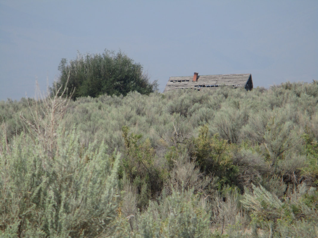
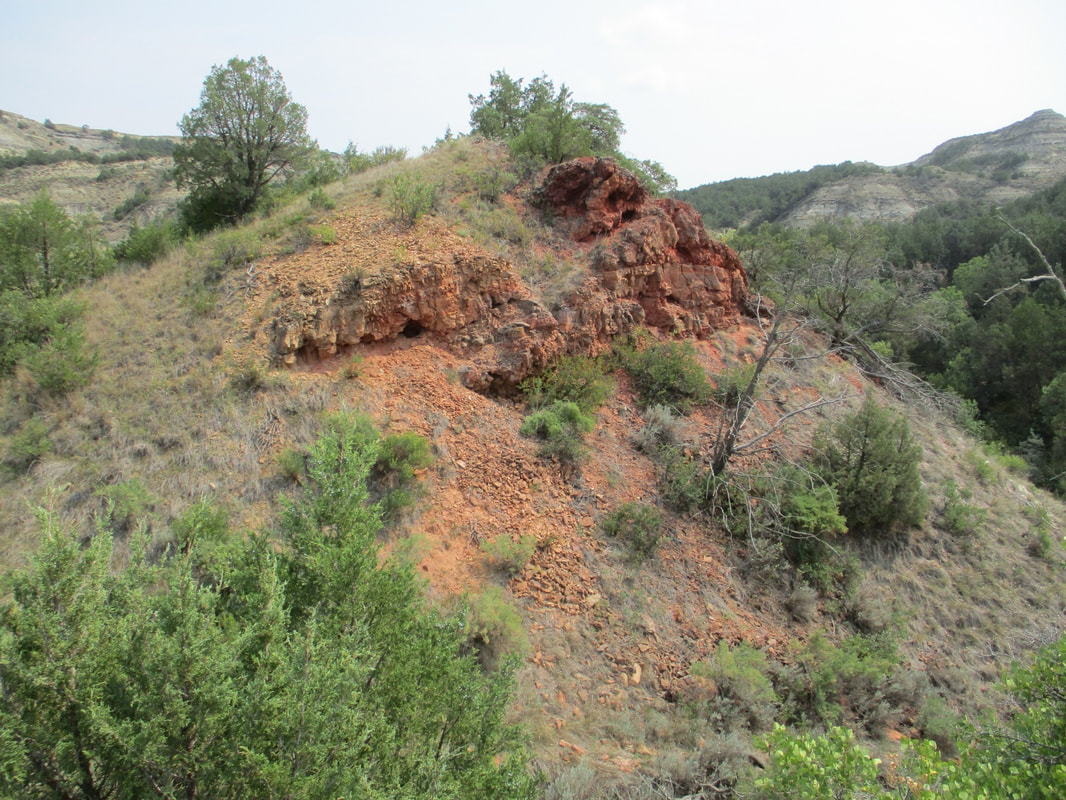
The ghost town of Bannack, view from Boot Hill.
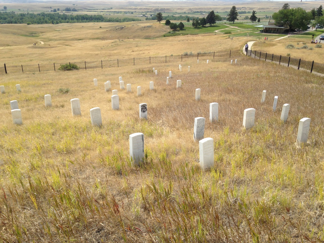
In an earlier installment of this series I mentioned “numbers” next to disease as one of the immediate causes of the Plains Indian apocalypse. Gold and silver explain the numbers. Miners and their hangers-on flooded in. The surviving ghost town of Bannack is the core of the older settlement; at its peak the valley in the photo above was covered with shacks, extending up all the nearby creeks and rivulets. The climax of the Sioux War was more than a decade away, and far to the east; associated with another gold strike, in the Sioux treaty lands in the Black Hills of South Dakota.

Numbers. The white migration into Montana and the Dakotas knew no borders. A
t the end of the Civil War, this population movement soon became more sudden and definitive than the tribal migrations of the Goths or the Vandals. The East, having succumbed to a racialized politico-military convulsion and the economic and moral collapse of the defeated Confederacy, spontaneously vomited war across the full length of its frontier. Desperados, outlaws, treasure seekers and failed men of every description, along with madly optimistic immigrants, sometimes whole families, swarmed west. To some extent territorial seizure was regulated by U.S. cavalry units left over from the butchery in the East, but the invasion itself was composed of civilian hordes; the professional cavalry were the wagging tail of this mass migration.

By no means were all the newcomers land seekers, and many did not intend to stay in the West. Many were seeking treasure in the ground, while others were seeking their treasure at gunpoint on the road from the mines. Thus Bannack, a very salty hellhole in its day—so disorderly that some of the details of its history are composed of conflicting accounts. 
Picture
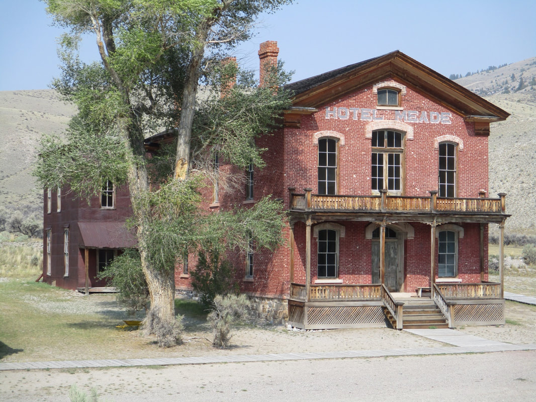
Beaverhead County Courthouse, built in 1875, later converted to a hotel.
Picture
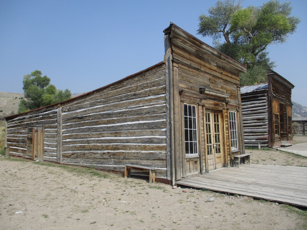
Vernacular architecture, Bannack.
The ambiguous saga of Sheriff Henry Plummer says much about life in early Bannack. First, though, it’s important to remember that Bannack lasted as a steadily shrinking high desert shantytown far into the 20th century, until the last resident left in the 1970s.
Picture
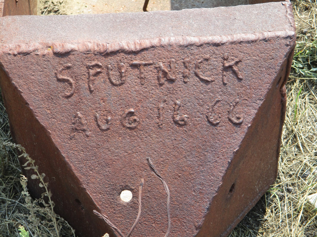
"Sputnick": 1960s dredge mining equipment, Bannack.
Sheriff Henry Plummer couldn’t have foreseen Sputnik. Hell, he didn’t even foresee his own hanging, even though he was the one who built Bannack’s first gallows. Bannack’s great blessing, gold, was the problem. Gold shipments regularly disappeared, leaving only corpses behind—over a hundred victims just from gold robberies alone, not including the other roughhousing going on. And there the story splits. Either the sheriff was named as the head of the gang by a murderer on the gallows, or else he was caught red-handed with his deputies. Either way he suddenly wound up with a rope around his neck and there the story splits again—he either claimed innocence and asked “for a good drop” or else offered to return “a wagonload of gold” if the Vigilantes would spare his life. Which they did not. We’re free to imagine Henry Plummer’s stolen gold out there under a rock somewhere, which would be a magnificent ending. 
Picture
Remains of authentic red velvet wallpaper from the old days of Bannack, later papered over with a more sedate pattern.
Picture
Dry air preserves Bannack.
Picture
Wandering the halls: Hotel Meade.
Picture
Bannack’s old saloon bears mute testimony to whiskey.
It must have taken many years for Bannack to calm down. Meanwhile, the territorial capital shifted to Virginia City after the enormous Alder Creek gold strike there. Geology once again made its weight felt politically. Life was wilder if anything and southwest Montana was briefly ruled at gunpoint by the Vigilantes, who were not necessarily universally popular. Neither was what passed for the law—the massive timbers of Bannack’s old jail are riddled with bullet holes.
Picture
Bannack's original jail.
Picture
Scarred.
Picture
So ornery they had to chain them to the floor: jail annex, Bannack.
Picture
Virginia City circa 1868. https://westernmininghistory.com/towns/montana/virginia-city/
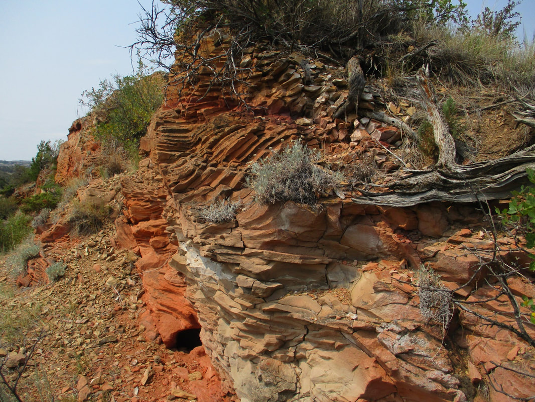
Geologically, ghost town Bannack is off the highway, unlike Virginia City and adjacent Nevada City, which survive as important roadside attractions.
Picture
Virginia City, MT.
The word “anarchy” is often a synonym for mad disorder and violence. Philosophically, though, anarchy is better described as a highly individualistic social system prizing personal autonomy above other social values. It’s a concept closely tied to “autarchy,” a social system (or part of a multi-tiered system) where the most socially elite, typically the richest or most powerful, are excused from the effects of law. Obviously much more could be said, especially in the academic context. It’s worth noting occasions where odd social systems like classical anarchy emerge briefly as founding conditions. Colonizing situations where a new population violently substitutes itself for a previous population seem to provide opportunities for considerable legal fluidity.
NEXT BLOG: POLITE FICTIONS
1 Comment

VISITING AMERICA Part 3: Another Side of Montana

9/13/2021

1 Comment

 
Should driving all the way across Montana entitle one to vote in Montana? It’s a long way across. I know nothing about Montana politics. I assume there are some. If the Montana legislature extends me a vote, I would vote Labor. I read that cattle are still king, with nearly 3 cows per person statewide. Copper, coal and oil also count for a lot. Montana is infused with minerals. It’s not a poor state though plenty of poor people live there.
​
Our route picked up the trail of Lewis and Clark on the Missouri River in North Dakota, and we were repeatedly on the track of their expedition all the way to Dillon, Montana. 

Picture
Lewis and Clark's map. Public Domain, https://commons.wikimedia.org/w/index.php?curid=499383
People traveling on foot gain a striking familiarity with their surroundings. That helps explain the astonishing liberty Captain William Clark took on July 26, 1806, during the return journey eastward, when he carved his name and the date near the top of Pompeys Pillar, a sandstone landmark on the banks of the Yellowstone, as a territorial claim on behalf of the United States. Pompeys Pillar is a historical sacred space called “Mountain Lion Lodge” in the Crow language, and many petroglyphs had already been painted or carved there over the millennia when Clark arrived. 
Picture
Pompeys Pillar.
Clark chiseled the first white cartouche on a sacred ancestral rock in a place more utterly mysterious than Coleridge’s Xanadu at the time. Many later travelers would do the same. We should probably conclude that the Crow took Clark for some curious and genial freak of nature, dragging expedition boats and provisions, shedding gifts, leading a gang of miscellaneous followers from beyond the beyond. They could not have known Clark’s petroglyph was actually a seal of doom. Nor could Clark have imagined such a thing. 
Picture
The sign reporting what Clark wrote about the view from Pompeys Pillar.
Picture
View from the top of Pompeys Pillar, August 2021.
Sixty-nine years and eleven months later, almost to the day, Custer’s 7th Cavalry Regiment took a legendary mauling at the Little Big Horn, not too far away as distances are reckoned in Montana.  If seventy years does not seem long enough to get from Clark in 1806 to the Sioux campaign of 1876, consider that Montana’s first capital, Bannack, was founded in 1862, only 56 years after Clark engraved his mark. Within the span of an ordinary lifetime the Plains societies were overrun and the land claimed by an alien civilization.

Picture
Rock shelter at Pictograph Cave State Park, near Billings MT.
The history of the Plains societies is truly ancient and yet largely unknown. Native Americans were following the buffalo on the plains at least 10,000 years ago, long before the pyramids, long before Ur. The Plains cultures were revolutionized around 1700 CE by the return of the horse to North America, but their roots were much older. Pictograph Cave and other adjacent rock shelters were sacred ceremonial places for Plains societies at least 5,000 years ago. One feels this estimate is far too short. Most of the pictographs here were lost before conservation, but archeology at the site has recovered over 30,000 artifacts. Nearby Ghost Cave seems to retain the memory of a haunted reputation. Such places remind us of what we do not know--about the passage of time, about the life of humanity.
Picture

Ghost Cave: memories of ceremonial power.
Picture
Interior of Ghost Cave, a sandstone rock overhang.


On their outward journey Lewis and Clark followed the Missouri into the Yellowstone near the North Dakota state line. Quite a while passed before the Rockies came into view near modern-day Billings. They were following the largest river system in North America.
Picture

Jefferson River and Tobacco Root Mountains north of Dillon, MT.
After hauling upstream as far as the Tobacco Root and Ruby Mountains the members of the Expedition certainly knew they had come awfully far across what would later be called Montana. “Both Capt. C. and myself corrisponded in opinion, with rispect, to the impropriety of calling either of these streams the Missouri and accordingly agreed to name them … we called the S.W. Fork, that which we meant to ascend, Jefferson's river in honor of Thomas Jefferson. the Middle fork we called Madison's River in honor of James Madison, and the S.E. Fork we called Gallitin's river in honor of Albert Gallitin.”—Meriwether Lewis.

Soon they were naming various headwaters after the elusive pillars of Thomas Jefferson’s character, Wisdom, Philosophy and Philanthropy. These names did not stick, but the Native American names were also lost. The Wisdom, Philosophy and Philanthropy Rivers are the Big Hole, Willow Creek, and Ruby today. Meriwether Lewis went up the Big Hole, or Wisdom River, trying to get to the Pacific divide. This route soon lost its promise, and Lewis had to climb, to understand the real lay of the land. Soon after the Big Hole failure, Lewis and Clark chose the Beaverhead route to cross the Pacific divide.


Picture
Obvious in the end.
Picture
The Hogback: A massive exposure of Paleozoic sandstones on the Big Hole River.
In some ways the stretch of journey around Dillon seems like the real climax of the Lewis and Clark story. Here Sakakawea was reunited with her brother, Cameahwait, on the side of US 41 in the shadow of Beaverhead Rock. Beaverhead Rock looks so much like a beaver head that the idle tourist today can imagine her shock of recognition. Some miles upstream the site of Camp Fortunate, where the Expedition got its first horses, lies drowned under the Clark Canyon Reservoir. As Donnie pointed out, the Big and Little Buffalo Rocks south of Dillon are indeed almost eerily bison-shaped, just as Sleeping Elk Mountain is remarkably shaped like a sleeping elk. Later we found Mountain Lion Rock, which could not have been any more obvious if it had been put there deliberately. Other important landmarks are strewn liberally across the region, their significance only vaguely recalled, once part of the Native American landscape system, more associative than ours, in which sometimes things are what they are, not merely where they are.
 
Donnie knows these legendary trout rivers very well from his years as fishing guide working out of Dillon. Sometimes it’s valuable to go back and see the important places in your life again. Dillon, population just over 4200, did not show the fishing activity Donnie expected to see. Concerns about smoke from the fires, Covid, and drought probably affected the local trout season. 
Some rivers were closed to fishing. The drought is real. Covid is a disaster, and the smoke from burning California hazed out the view of the Rockies. There was fishing activity on the Madison, but basically this sport-and-tourism corner of Montana is obviously hard hit in 2021. It was interesting in Dillon and later in Virginia City to see what was closed on Mondays and Tuesdays versus Tuesdays and Wednesdays, or if the owner was working the counter from labor shortage. The sudden and near-complete loss of rental vehicles also cuts deep. To go to Dillon, you have to have something to drive. Walking remains impractical over such distances, despite the example of Lewis and Clark.

Not far from the strangely deserted trout fishing put-in where Lewis climbed the Hogback on August 5, 1805, the Nez Perce exiles stood off the U.S. cavalry for the last time at the Battle of Big Hole on August 9-10, 1877. The tragedy of the Nez Perce, driven from the Pacific Northwest onto a reservation in Idaho, then escaping into the Montana ranges in search of allies or at least a place they could defend, was the next-year sequel of the 1876 Sioux campaign. We must add this to our haunted reckoning of the Native American apocalypse.

The 
strategy and planning behind the 19th century cavalry campaigns in the West seem haphazard in their details. Aficionados of Civil War studies won’t recognize the same Grant and Sheridan, Crook or Custer, the same Major General O.O. Howard or Gibbon. The tactics seem clumsy, colonial, below military grade. The officers themselves thought so too—they spent much of their time making excuses for failures, casting blame, and trying to cover up grotesque mistakes. “What did they know and when did they know it” was an 1877 press meme. Somehow, corruptly, military operations in the West were a public scandal. It takes a second round of thinking to recognize that, despite the flags and the bugles, the context of these operations was not actually military. The Native Americans had already been absolutely and utterly defeated long since. The cavalry firepower was for policing reservations. Catching bands of escapees was the only strategy needed, in a pattern going back to the Dakota War in southwest Minnesota in 1862. It was already obvious that disease and numbers had settled the land tenure question.

The Plains societies collapsed like bubbles. When Lewis and Clark reached the Mandan lands in 1805, they found freshly desolated villages and a smallpox epidemic in full swing. Eastern diseases would sweep through the Plains repeatedly in the decades that followed, a pattern seen in North America since the first Spanish landings and settlements in the 1500s.

www.ndstudies.gov/gr8/content/unit-ii-time-transformation-1201-1860/lesson-4-alliances-and-conflicts/topic-1-smallpox-epidemics-1781-1837-1851/section-3-smallpox-epidemic-1837

The final fatal blow to the Plains societies—the annihilation of the bison herds—came late and seems almost unnecessary. 
At that point the Sioux had already been reduced to a trapped remnant But bison are dangerous and cows aren’t. Clearly settlers with cows needed the bison to go away too. 

The landscape seems somewhat haunted by its historically recent human and environmental apocalypse. Facts about history are often facts about the present as well. The vast migrating herds of bison and elk were not replaced by vast herds of cows. Cows are far too expensive to risk any sort of surplus. Driving through Montana, I could not help fantasizing about putting the bison, elk and wolves back. As wild animals, they might very well support themselves, which cattle cannot do.

We approach landscapes through names. Sometimes the name we use has an older name behind it. Native American names are strewn across the landscape intermixed with settler names. Sometimes the stories explaining the settler names are as forgotten or mysterious as the Indian names, already with one foot in the world of ghosts. 

Picture
Ghosts. Last relics of a miner’s shack, 1870s-1900. 
Picture
High desert.
Picture
A McKinley-era ranch house lost in the sagebrush.
In the main, though, landscapes are sensitive to much more than mere human history. Volcanic intrusions along the seams of sedimentary rocks in the Montana ranges left deposits of gold, silver, copper and other valuable metal ores, recognizable by their characteristic suites of intruded rocks. Around Dillon the landscape vividly recalls this happening at least twice, in the later Cretaceous and then again in the Eocene.
Picture
Many a miner was dry gulched.
Picture
Intrusions.
Lava intrusions were a side effect of the western Montana tectonic train wreck that lifted and displaced gigantic regional chunks and carried them for many miles off to the east, double-stacking the landscape. As the great overthrust progressed, plate subduction drifted farther in the direction we now call west, as new sheets were piled up against the rising Rockies. Even the gap Lewis and Clark used to reach the Pacific Basin is a relic of the old remembered days when the Beaverhead River ran briskly off to the nearest sea, instead of being hoisted up and tilted off towards the far end of a still-growing continent. All the Expedition’s newly renamed rivers were divorced from their original ocean and since remarried. Not the sort of thing a real landscape forgets very easily. It explains a lot, locally and also in general. 
NEXT BLOG: ANARCHY IN BANNACK
1 Comment

Visiting America Part 2: A Feeling of Isolation

9/7/2021

0 Comments

 
“…the only thought which comes to me is a feeling of their isolation…” Arthur Conan Doyle, “The Adventure of the Copper Beeches.”
Describing the land tracts, leases and public lands of eastern Montana would not convey a sense of presence. One cannot conceive the life and society of the High Plains by driving through. Fortunately my traveling companion and cousin, Donnie Mawyer, spent decades as a hunting and fishing guide and occasional cowboy in Montana. Montana is the big leagues for fish and game, with vast sprawling Pleistocene landscapes and literally legendary fishing rivers like the Madison and the Jefferson. 
Picture

​Donnie Mawyer on the Little Big Horn.
The guide has to be a naturalist, pack animal and boat handler, gun and rod expert, wilderness navigator, camp host, and much else besides. You have to like animals and you have to like people, and in the end you have to be able to sight an East Coast banker in on an elk four football fields away, and then finesse your banker into actually hitting his elk. Understanding how important the trip and the trophy are to the client was Donnie’s most special skill as a guide. His sensitivity made him a celebrity guide and sensei of other guides. Then there were the necessary jobs of convenience to fill in the off seasons, because even a very good hunting and fishing guide still has bills to pay.

Cowboy life is rough stuff even when everything goes as well as could be. Throw in a few horse wrecks and bull stompings and no wonder the old cowboys in the old bars in remote towns in Montana appear physically and emotionally mangled. There’s nobody going to come up to these old prairie salts and say “Damn glad you did that to yourself—what a terrific choice.” Just to vary the possibilities, let an oilfield or two spring up in the local geology and you can add being worn down by heavy machinery to your resume. 
Picture
An iron grasshopper. Baker Oil Field, Wibaux Co. MT.
Picture
A far-flung road north of Wibaux.
The guide and game situation in Montana is not as easy as it was. There is less game and the rules have changed. The world has changed. The situation for ranchers, who are the responsible society of this part of the High Plains, is also not getting better. We knew about the drought before we went. It is severe, as is the fire risk. We learned the 2021 price of hay for the winter has shot up 300%, and this will probably sell out some ranchers. These details could have been guessed in advance, very Adam Smithianly. The grasshoppers, however, were a surprise. So many grasshoppers were plastered to the front of my car for the rest of the trip that I did not think to take any grasshopper photos. I regret it. A multi-generational grasshopper infestation was in full swing in Wibaux County, enough for the locals to feel the economic impact. I guess I can check “locust plague” off my bucket list the way Don’s old doctor and lawyer clients checked off “elk,” “grizzly” and “mountain goat.”
Picture
Wibaux, MT. Population approximately 600.
Picture
The corner of Main and First Street, Beach, North Dakota. Population just over a thousand.
Clearly these High Plains towns have been larger and more prosperous than they currently are. It’s quite obvious that there was once more to these places. It’s as if a certain pattern of early 20th century town and community growth was broken off, and then resumed in a different 1960s pattern, resulting in the newer town or village growing out as a weak appendage of the now nearly dead historic core. This, I think, is what it looks like. The most obvious explanation to me is ghosts. We living beings flounder around with very little concern for the dead and the spirits of things around us, and where people are thin on the ground the situation is emotionally not too stable.
Picture
Old railroad hotel and open invitation to get haunted. Dillon, Montana.
Modernity is the interstate. The larger towns have interstate exits with gas and convenience stations, fast food and motels. Dickinson, where we stayed three nights, is large enough to have a dead mall, but too small to overpower its exits, which have come to dominate the town so neatly split down the middle. However, an interstate exit equals jobs. A big cluster like Dickinson equals quite a lot of interstate service jobs. It’s not nothing. The population of Dickinson, ND is over 25,000. It’s the regional capital. The next regional capital west of there is Glendive, MT, population about 6000. Glendive’s a good place for a Creationist museum. It’s pretty clear the population is mainly composed of Dissenters—all kinds. It’s dissenters and more dissenters all the way.

Blame 
belongs to Easterners for all the things there are to dissent from. Viewed from the High Plains, the Easterners are very obviously in charge of the world, and they’re not doing a very good job. The High Plains and the High Desert are on their own and they know it. This reminds to me ask who the last Western president was. Nebraska: Gerald Ford. LBJ was a Texan but then we have to speculate whether Texas is part of the rest of the West or somewhat like a different country. If Kansas is west enough, then the answer could be Eisenhower (also born in Texas though). California is not the west, it's the coast. There has never been a Mountain West president. It’s possible that as a nation and as a people, so to speak, we could do with a crack at that.

These are the people, and agriculture, specifically the ranches, remains the chief economic and civilizational explanation for life on the High Plains. This despite the Billings refineries, a brief hydrocarbon boom and the reasonable expectation that there will be another. The stick-togetherness is about farming and cattle on these vast expanses. An active social life requires burning a lot of gas. And success on the ranch requires equipment. A combine harvester can cost half a million dollars. Being a rancher is like having several largely entrepreneurial full-time jobs at the same time. Prosperity hangs by a thread. But I speak as a retired editor, the most ruthlessly unprosperous profession in America. So on some levels these guys are pretty lucky. And they have the Badlands.

And the K-T Boundary, and the mass extinction that ended the Mesozoic. And the ever-looming possibility of that dinosaur jackpot. Like Dinosaur Dan, living in a trailer with thirteen children, hitting a multimillion dollar T. rex and, two divorces later, very nearly half-ruined again. I did not meet Dinosaur Dan. A guy deserves some privacy. You need privacy to be a legend, and Montana can still produce legends.


Picture
I need privacy.
Picture
Hard rock on the anticline, Wibaux County.
Picture
Steeper than it looks.
Picture
A glorious honey-gold sandstone.
NEXT BLOG: ANOTHER SIDE OF MONTANA
0 Comments

VISITING AMERICA PART ONE:  The Fort Union Formation

9/2/2021

1 Comment

 
With fire, floods and Covid raging, could there be a better time to explore America? It seems to me we are surrounded by history in the making, because I don't believe the US is going to return to the conditions and circumstances of 2019, in retrospect...
Picture

"Speak no evil": one of three tree trunk yard monkeys outside Latrobe PA.
"Let's go visit history," my cousin Don suggested. Don is a retired hunting and fishing guide, and our main objectives were eastern and southwestern Montana, the principal scenes of Don's wilderness guide career. Yellowstone was planned next, then a return drive through southeastern Montana, visiting the Little Big Horn battlefield and Wounded Knee. In the end we went farther than we meant to go.

Montana is a huge state, about 70% the size of France. Every state in the Union is eventually measured against the size of France for quick comprehension, a meme that will outlive us all. Apparently France is why the chicken crossed the road. Seemingly no one ever questions our understanding of how large France is.

Unable to fly and then rent a vehicle, a national situation caused by the combination of Covid and economic brittleness, we could only drive. No longer were Pennsylvania, Wisconsin and Minnesota flyover states; they became drive-through states. It's unfair; these states are replete with weird little features and points of interest. But the interstates only allow a distant glimpse. At the end of the third day of our trip we reached Dickinson, North Dakota, and considered our journey to have properly started.
Picture
Approaching Dickinson, ND from the visitor center on I-94.
The hero of the southwestern North Dakota badlands is the Fort Union Formation, composed of Paleocene mudstones, lignite and brick, lying over similar mudstones and shales of the dinosaur-rich Hell Creek Formation. The Cretaceous Hell Creek Formation is separated from the Paleocene by the iridium-rich K-T Boundary, which marks the asteroid that killed the dinosaurs and ended the Mesozoic Era. This was a big event in earth history, but in North Dakota and Montana it did not apparently affect the inland sea/lagoon morphology of the landscape very much. Deposition went remorselessly on.
Picture
The North Dakota Badlands: From the Painted Canyon Visitor Center on I-94 west of Dickinson.
The magnificent Theodore Roosevelt National Park (TRNP) displays the badlands gloriously. The two units of the TRNP are intricate mazes with hard-surface one-way roads maintained by the Park Service, connecting to hiking trails and scenic walks. The two units are about 60 miles apart. The northern unit is well away from the interstate, features the upper waters of the Little Missouri River, and is more deeply cut.
Picture
Valley of the Little Missouri.
These clay formations are carved by water, and slumping is the main erosional form. The TR has spectacular examples of the kinds of iron nodules that form in such settings, originally as algal/bacterial gels at the bottom of what must have been somewhat stagnant lagoons.
Picture
Cannonball nodules, North TRNP.
Picture
Eroded gulch with cannonball nodules, North TRNP.
Picture
Both units of the TRNP have lots of wildlife: a bull bison looking into the window of the car.
Picture
Bison in the South Unit, posing for nickels.
Sage, prairie dogs, bison, turkeys, mule deer, antelope and countless other things milled about the TRNP in profusion. A painter or photographer might easily go insane in there. As Don said, most national parks are embedded in the present as preserved and protected lands. But when you look at the Theodore Roosevelt, it's as if you're looking back in time.
Picture
Striated clay mudstones, with bison herd in the middle distance.
Structurally, the Fort Union Formation and the Hell Creek Formation under it are composed of stream beds, river deltas and marine lagoon margins that ebbed and flowed across the landscape for tens of millions of years. Intermittent swampy forests laid down dense mats of plant matter, quickly buried in this depositional setting and gradually compressed into soft coal or lignite. The lignite layers are the softest element in these bands of compressed clay. When lignite becomes exposed on the surface the erosion is more or less immediate.
Picture
A lignite lens is doing very little to protect this ridge from erosion above the Little Missouri.
Picture
Fort Union lignite from Wibaux County, Montana--note bark fragments.
These soft coal seams can be ignited by lightning strikes or wildfires, and they may flame up or smolder for years or decades. A seam burning in the TRNP now has been cooking along for years. These slow fires bake the clay layer above into brick, or scoria. These layers of fairly hard red scoria become cap rocks protecting the soft mudstones beneath from sudden erosion. The whole thing is strangely architectural.
Picture
"Brick" or scoria cap rock. Loss of the burned lignite layers leads the brick to slump.
Picture
Another badlands cap rock: weak shale.
Other cap rocks include a weak shale, and at the highest point in the south unit of the TRNP the cap rock is a sandstone stream bed deposit. Sandstone concretions lead to the creation of hoodoos.
Picture
Little hoodoos everywhere.
Picture
Calling a bluff.
The astonishing prairie dogs and bison justified the trip, for sure, but the mudstone-lignite-brick architectural system of the Fort Union badlands is otherworldly. Non-volcanic scoria is a winning concept to this simple mind. It's fascinating to think of this natural structure as an extension of the Cretaceous. The Fort Union Formation extends deeply into Montana, where the Hell Creek Formation surfaces occasionally in Wibaux County. An adventitious local uplift of the Hell Creek near Glendive runs off to the southeast for many miles, and Makoshika State Park on the edge of Glendive exposes the K-T Boundary along with a massive cross-section of the Fort Union. The Yellowstone River has left vast and grandiose monuments here.
Picture
Makoshika.
Picture
Gigantic hoodoos.
Picture
Huddled masses yearning to break free.
The Hell Creek Formation is one of the smoking guns for the end of the Cretaceous and the extinction of the dinosaurs. Visitors come for the dinosaurs as much as the scenery. Montana State University's Museum of the Rockies in Bozeman has a world-class display and dinosaur enthusiasts might consider spending a full day in this beautiful museum, wallowing in catastrophic numbers of fresh dinosaur finds, room after room.
Picture
Meet the locals at the Museum of the Rockies in Bozeman, Mt.
Other site-local exhibits include a very good display at the small Dickinson Dinosaur and Badlands Museum, and a noteworthy collection at the Glendive Dinosaur and Fossil Museum. The Glendive museum is Creationist, and I greatly regret not taking a photo of the Noah's Ark diorama showing all the plastic dinosaurs that wouldn't fit on board. But to paraphrase Abraham Lincoln, "Let us cut us a break sometimes." When I was a child my plastic dinosaurs fought my plastic cowboys relentlessly. The title of this fresh series of blogs is "Visiting America" and there is nothing more American than Creationism.
Picture
Edge of the Badlands. Note chuck wagon and cattle drive in the middle distance.
Scenes of the long slow collapse of these Paleocene clay formations would go on to haunt us, butte by butte, for many, many hundreds of miles to come...
NEXT BLOG: A FEELING OF ISOLATION
1 Comment
    Picture

    Author

    Gary Dale Mawyer, a Central Virginia native, has over 40 years of publishing and editing experience and lives with his wife Karen and two cats in Albemarle County. 

    Buy Gary's books now

    Sites I like

    afroculinaria.com/
    ​
    largea.wordpress.com/​livinglisteningandthingsilove
    naturalpresencearts.com/
    someperfectfuture.com

    RSS Feed

    Archives

    September 2022
    October 2021
    September 2021
    January 2021
    November 2020
    October 2020
    September 2020
    July 2020
    June 2020
    May 2020
    April 2020
    March 2020
    October 2019
    August 2019
    July 2019
    June 2019
    September 2018
    August 2018
    December 2017
    October 2017
    September 2017
    August 2017
    December 2016
    November 2016
    October 2016
    August 2016
    April 2016
    January 2016
    November 2015
    October 2015
    September 2015
    August 2015
    July 2015
    June 2015
    May 2015
    March 2015
    February 2015
    January 2015
    December 2014
    November 2014
    October 2014
    September 2014
    August 2014
    July 2014
    June 2014
    May 2014
    April 2014
    March 2014
    February 2014
    January 2014
    December 2013
    November 2013
    October 2013