Should driving all the way across Montana entitle one to vote in Montana? It’s a long way across. I know nothing about Montana politics. I assume there are some. If the Montana legislature extends me a vote, I would vote Labor. I read that cattle are still king, with nearly 3 cows per person statewide. Copper, coal and oil also count for a lot. Montana is infused with minerals. It’s not a poor state though plenty of poor people live there.
Our route picked up the trail of Lewis and Clark on the Missouri River in North Dakota, and we were repeatedly on the track of their expedition all the way to Dillon, Montana.
Our route picked up the trail of Lewis and Clark on the Missouri River in North Dakota, and we were repeatedly on the track of their expedition all the way to Dillon, Montana.
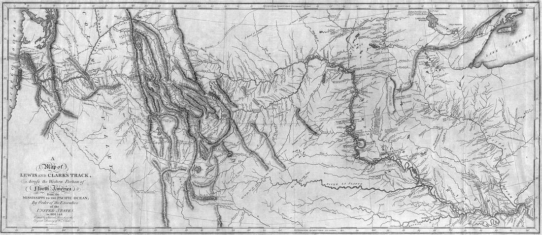
Lewis and Clark's map. Public Domain, https://commons.wikimedia.org/w/index.php?curid=499383
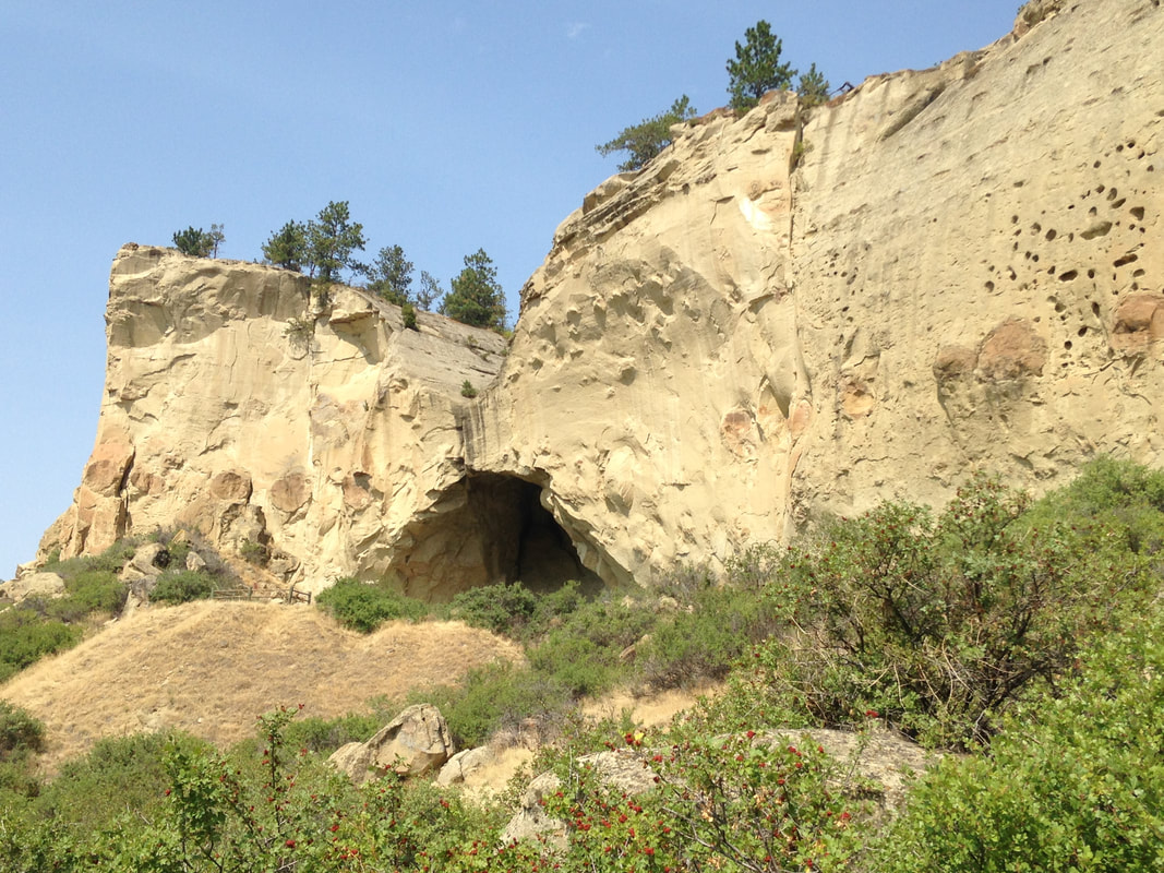
People traveling on foot gain a striking familiarity with their surroundings. That helps explain the astonishing liberty Captain William Clark took on July 26, 1806, during the return journey eastward, when he carved his name and the date near the top of Pompeys Pillar, a sandstone landmark on the banks of the Yellowstone, as a territorial claim on behalf of the United States. Pompeys Pillar is a historical sacred space called “Mountain Lion Lodge” in the Crow language, and many petroglyphs had already been painted or carved there over the millennia when Clark arrived.
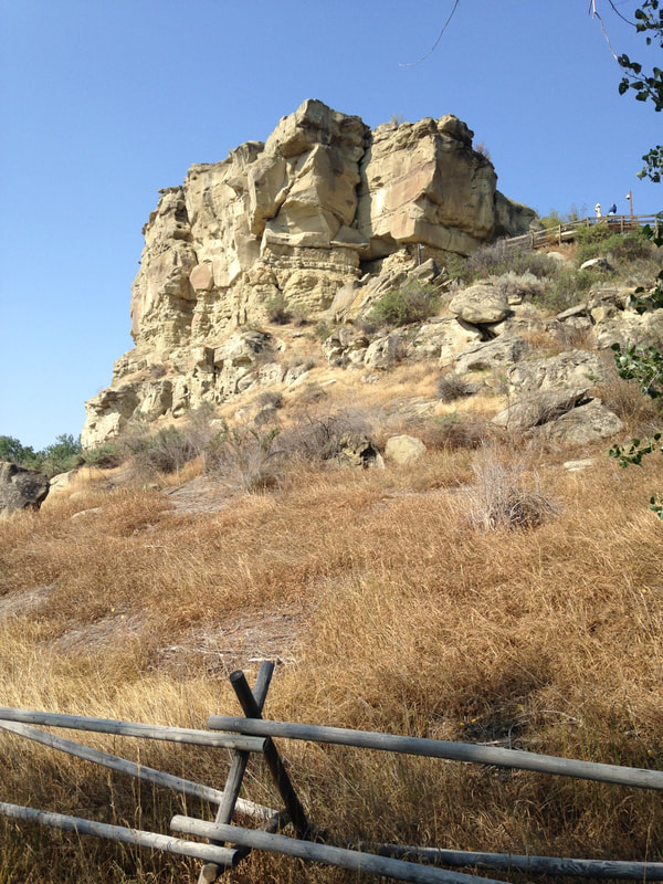
Pompeys Pillar.
Clark chiseled the first white cartouche on a sacred ancestral rock in a place more utterly mysterious than Coleridge’s Xanadu at the time. Many later travelers would do the same. We should probably conclude that the Crow took Clark for some curious and genial freak of nature, dragging expedition boats and provisions, shedding gifts, leading a gang of miscellaneous followers from beyond the beyond. They could not have known Clark’s petroglyph was actually a seal of doom. Nor could Clark have imagined such a thing.
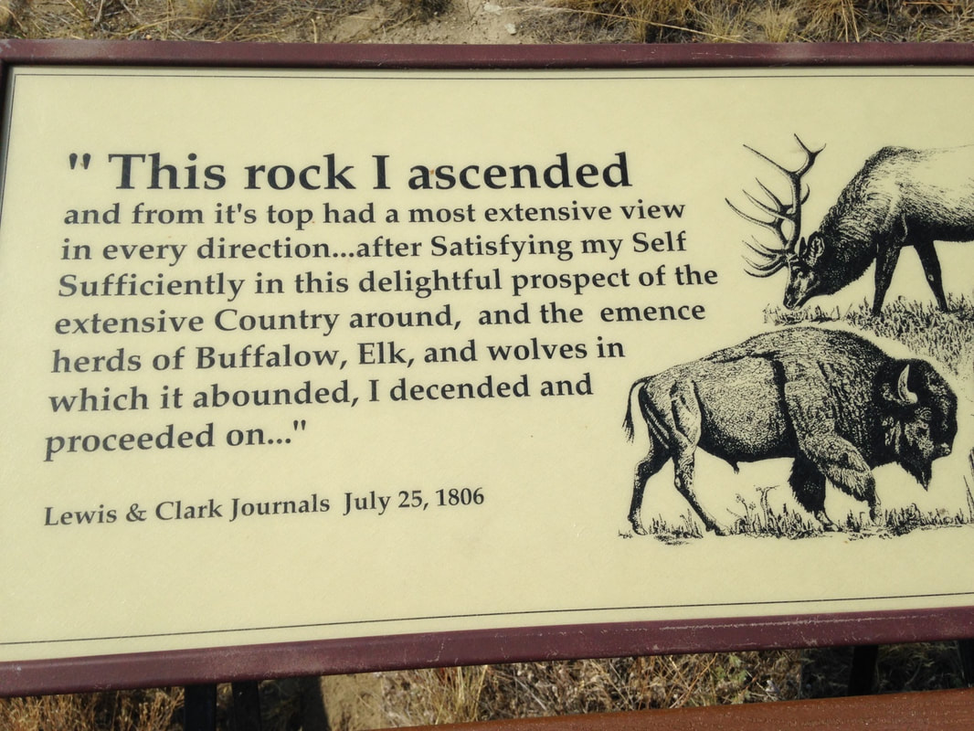
The sign reporting what Clark wrote about the view from Pompeys Pillar.
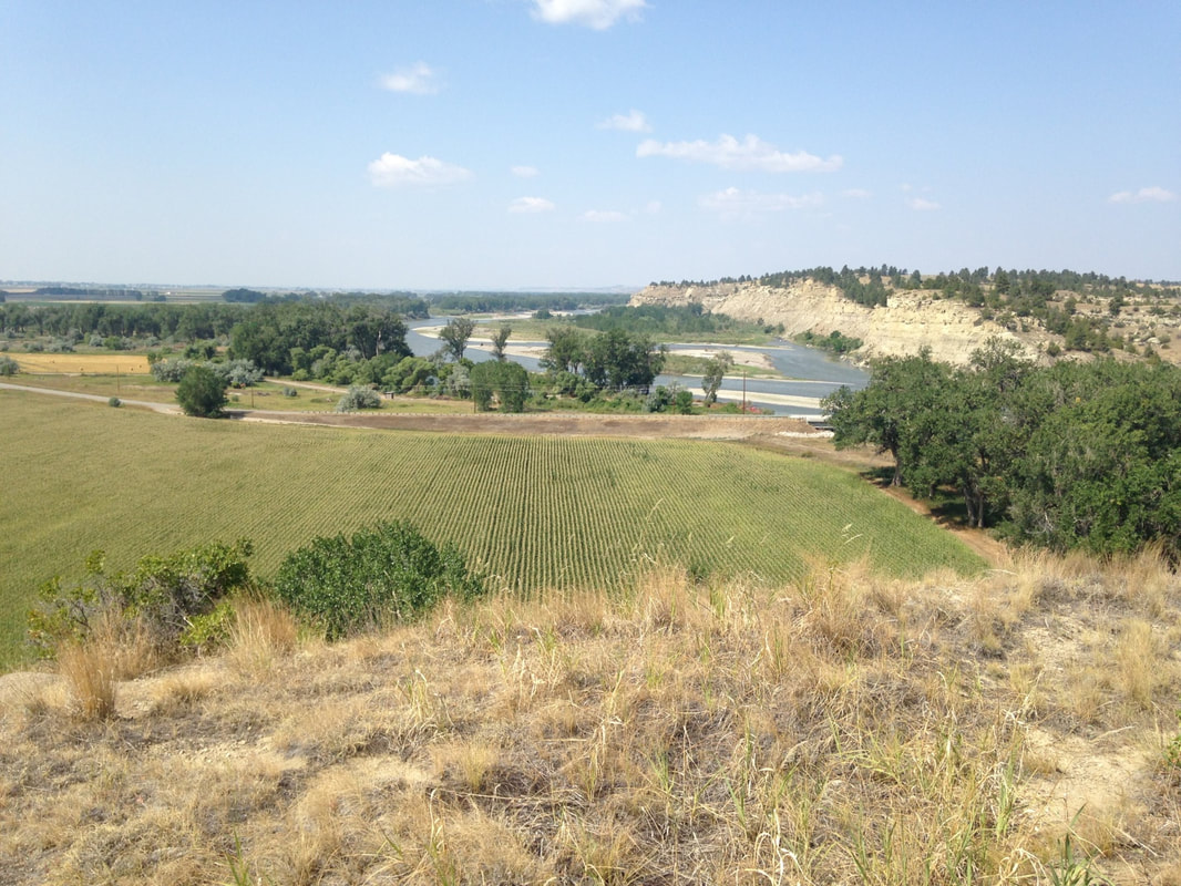
View from the top of Pompeys Pillar, August 2021.
Sixty-nine years and eleven months later, almost to the day, Custer’s 7th Cavalry Regiment took a legendary mauling at the Little Big Horn, not too far away as distances are reckoned in Montana. If seventy years does not seem long enough to get from Clark in 1806 to the Sioux campaign of 1876, consider that Montana’s first capital, Bannack, was founded in 1862, only 56 years after Clark engraved his mark. Within the span of an ordinary lifetime the Plains societies were overrun and the land claimed by an alien civilization.
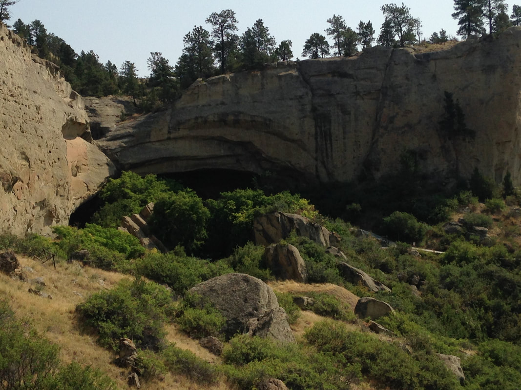
Rock shelter at Pictograph Cave State Park, near Billings MT.
The history of the Plains societies is truly ancient and yet largely unknown. Native Americans were following the buffalo on the plains at least 10,000 years ago, long before the pyramids, long before Ur. The Plains cultures were revolutionized around 1700 CE by the return of the horse to North America, but their roots were much older. Pictograph Cave and other adjacent rock shelters were sacred ceremonial places for Plains societies at least 5,000 years ago. One feels this estimate is far too short. Most of the pictographs here were lost before conservation, but archeology at the site has recovered over 30,000 artifacts. Nearby Ghost Cave seems to retain the memory of a haunted reputation. Such places remind us of what we do not know--about the passage of time, about the life of humanity.
Ghost Cave: memories of ceremonial power.
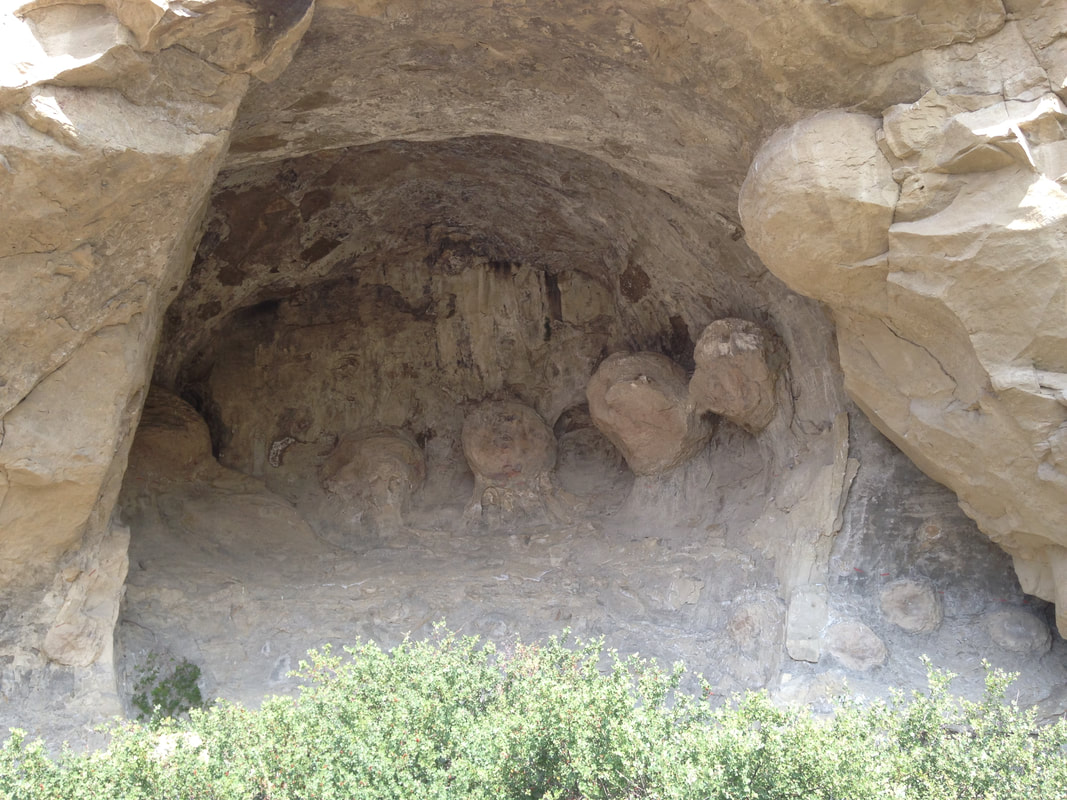
Interior of Ghost Cave, a sandstone rock overhang.
On their outward journey Lewis and Clark followed the Missouri into the Yellowstone near the North Dakota state line. Quite a while passed before the Rockies came into view near modern-day Billings. They were following the largest river system in North America.
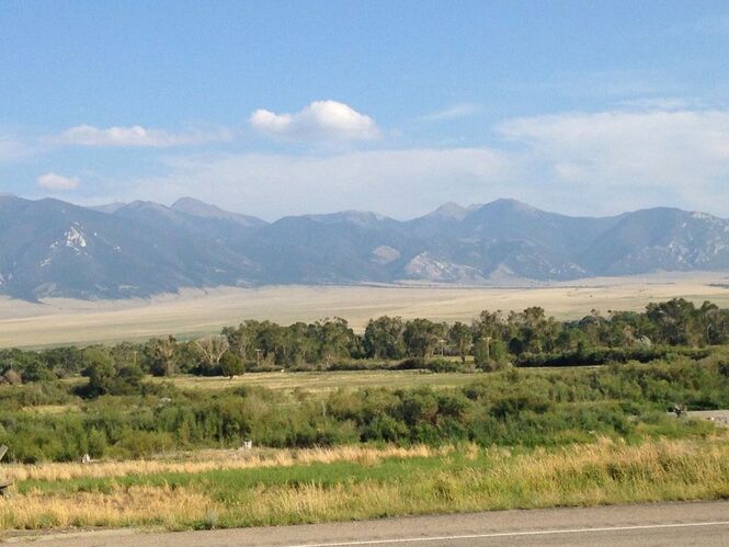
Jefferson River and Tobacco Root Mountains north of Dillon, MT.
After hauling upstream as far as the Tobacco Root and Ruby Mountains the members of the Expedition certainly knew they had come awfully far across what would later be called Montana. “Both Capt. C. and myself corrisponded in opinion, with rispect, to the impropriety of calling either of these streams the Missouri and accordingly agreed to name them … we called the S.W. Fork, that which we meant to ascend, Jefferson's river in honor of Thomas Jefferson. the Middle fork we called Madison's River in honor of James Madison, and the S.E. Fork we called Gallitin's river in honor of Albert Gallitin.”—Meriwether Lewis.
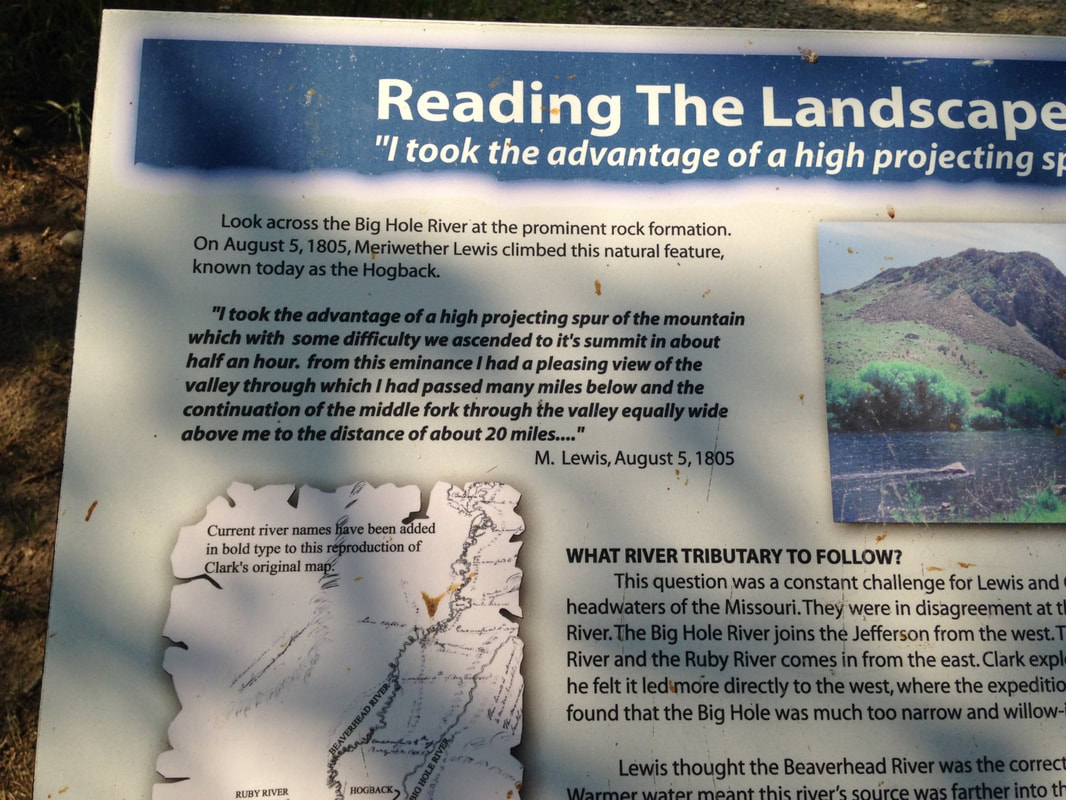
Soon they were naming various headwaters after the elusive pillars of Thomas Jefferson’s character, Wisdom, Philosophy and Philanthropy. These names did not stick, but the Native American names were also lost. The Wisdom, Philosophy and Philanthropy Rivers are the Big Hole, Willow Creek, and Ruby today. Meriwether Lewis went up the Big Hole, or Wisdom River, trying to get to the Pacific divide. This route soon lost its promise, and Lewis had to climb, to understand the real lay of the land. Soon after the Big Hole failure, Lewis and Clark chose the Beaverhead route to cross the Pacific divide.
Soon they were naming various headwaters after the elusive pillars of Thomas Jefferson’s character, Wisdom, Philosophy and Philanthropy. These names did not stick, but the Native American names were also lost. The Wisdom, Philosophy and Philanthropy Rivers are the Big Hole, Willow Creek, and Ruby today. Meriwether Lewis went up the Big Hole, or Wisdom River, trying to get to the Pacific divide. This route soon lost its promise, and Lewis had to climb, to understand the real lay of the land. Soon after the Big Hole failure, Lewis and Clark chose the Beaverhead route to cross the Pacific divide.
Obvious in the end.
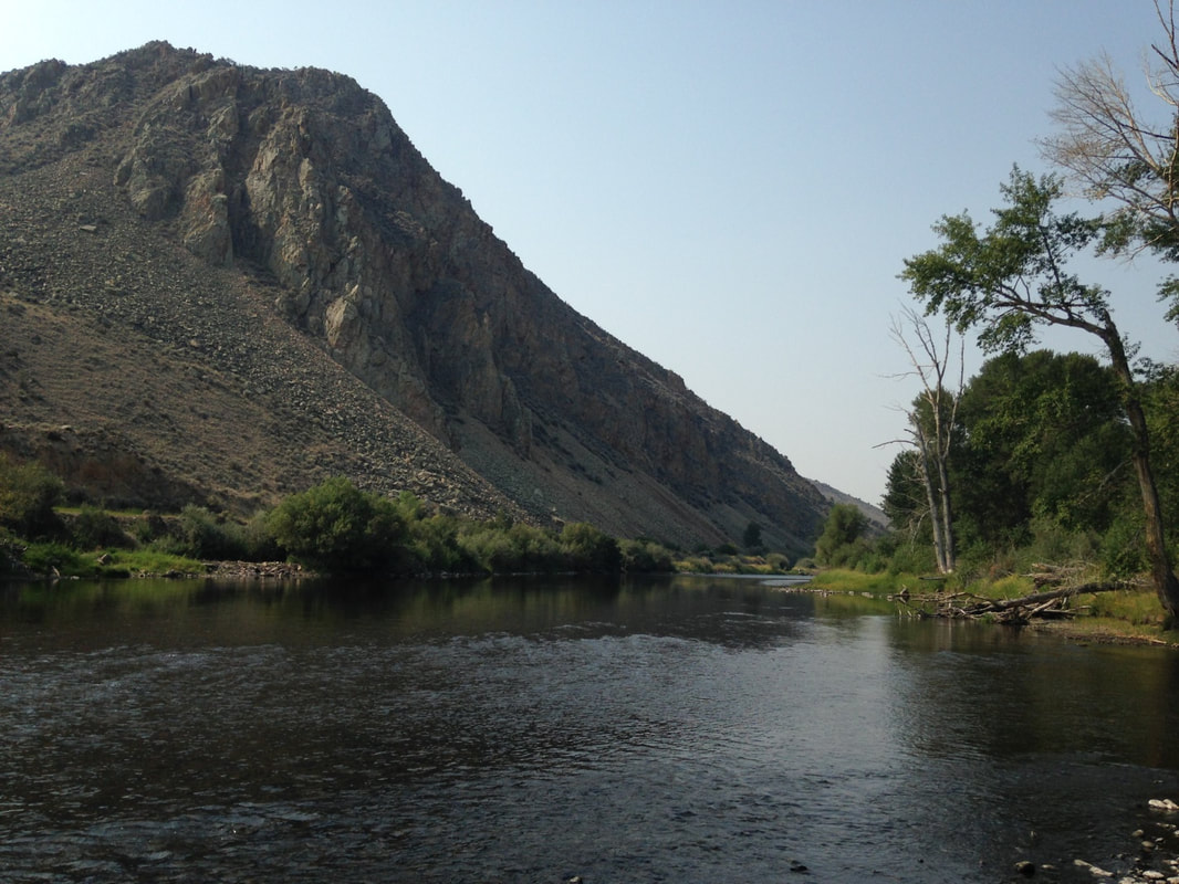
The Hogback: A massive exposure of Paleozoic sandstones on the Big Hole River.
In some ways the stretch of journey around Dillon seems like the real climax of the Lewis and Clark story. Here Sakakawea was reunited with her brother, Cameahwait, on the side of US 41 in the shadow of Beaverhead Rock. Beaverhead Rock looks so much like a beaver head that the idle tourist today can imagine her shock of recognition. Some miles upstream the site of Camp Fortunate, where the Expedition got its first horses, lies drowned under the Clark Canyon Reservoir. As Donnie pointed out, the Big and Little Buffalo Rocks south of Dillon are indeed almost eerily bison-shaped, just as Sleeping Elk Mountain is remarkably shaped like a sleeping elk. Later we found Mountain Lion Rock, which could not have been any more obvious if it had been put there deliberately. Other important landmarks are strewn liberally across the region, their significance only vaguely recalled, once part of the Native American landscape system, more associative than ours, in which sometimes things are what they are, not merely where they are.
Donnie knows these legendary trout rivers very well from his years as fishing guide working out of Dillon. Sometimes it’s valuable to go back and see the important places in your life again. Dillon, population just over 4200, did not show the fishing activity Donnie expected to see. Concerns about smoke from the fires, Covid, and drought probably affected the local trout season. Some rivers were closed to fishing. The drought is real. Covid is a disaster, and the smoke from burning California hazed out the view of the Rockies. There was fishing activity on the Madison, but basically this sport-and-tourism corner of Montana is obviously hard hit in 2021. It was interesting in Dillon and later in Virginia City to see what was closed on Mondays and Tuesdays versus Tuesdays and Wednesdays, or if the owner was working the counter from labor shortage. The sudden and near-complete loss of rental vehicles also cuts deep. To go to Dillon, you have to have something to drive. Walking remains impractical over such distances, despite the example of Lewis and Clark.
Not far from the strangely deserted trout fishing put-in where Lewis climbed the Hogback on August 5, 1805, the Nez Perce exiles stood off the U.S. cavalry for the last time at the Battle of Big Hole on August 9-10, 1877. The tragedy of the Nez Perce, driven from the Pacific Northwest onto a reservation in Idaho, then escaping into the Montana ranges in search of allies or at least a place they could defend, was the next-year sequel of the 1876 Sioux campaign. We must add this to our haunted reckoning of the Native American apocalypse.
The strategy and planning behind the 19th century cavalry campaigns in the West seem haphazard in their details. Aficionados of Civil War studies won’t recognize the same Grant and Sheridan, Crook or Custer, the same Major General O.O. Howard or Gibbon. The tactics seem clumsy, colonial, below military grade. The officers themselves thought so too—they spent much of their time making excuses for failures, casting blame, and trying to cover up grotesque mistakes. “What did they know and when did they know it” was an 1877 press meme. Somehow, corruptly, military operations in the West were a public scandal. It takes a second round of thinking to recognize that, despite the flags and the bugles, the context of these operations was not actually military. The Native Americans had already been absolutely and utterly defeated long since. The cavalry firepower was for policing reservations. Catching bands of escapees was the only strategy needed, in a pattern going back to the Dakota War in southwest Minnesota in 1862. It was already obvious that disease and numbers had settled the land tenure question.
The Plains societies collapsed like bubbles. When Lewis and Clark reached the Mandan lands in 1805, they found freshly desolated villages and a smallpox epidemic in full swing. Eastern diseases would sweep through the Plains repeatedly in the decades that followed, a pattern seen in North America since the first Spanish landings and settlements in the 1500s.
www.ndstudies.gov/gr8/content/unit-ii-time-transformation-1201-1860/lesson-4-alliances-and-conflicts/topic-1-smallpox-epidemics-1781-1837-1851/section-3-smallpox-epidemic-1837
The final fatal blow to the Plains societies—the annihilation of the bison herds—came late and seems almost unnecessary. At that point the Sioux had already been reduced to a trapped remnant But bison are dangerous and cows aren’t. Clearly settlers with cows needed the bison to go away too.
The landscape seems somewhat haunted by its historically recent human and environmental apocalypse. Facts about history are often facts about the present as well. The vast migrating herds of bison and elk were not replaced by vast herds of cows. Cows are far too expensive to risk any sort of surplus. Driving through Montana, I could not help fantasizing about putting the bison, elk and wolves back. As wild animals, they might very well support themselves, which cattle cannot do.
We approach landscapes through names. Sometimes the name we use has an older name behind it. Native American names are strewn across the landscape intermixed with settler names. Sometimes the stories explaining the settler names are as forgotten or mysterious as the Indian names, already with one foot in the world of ghosts.
Ghosts. Last relics of a miner’s shack, 1870s-1900.
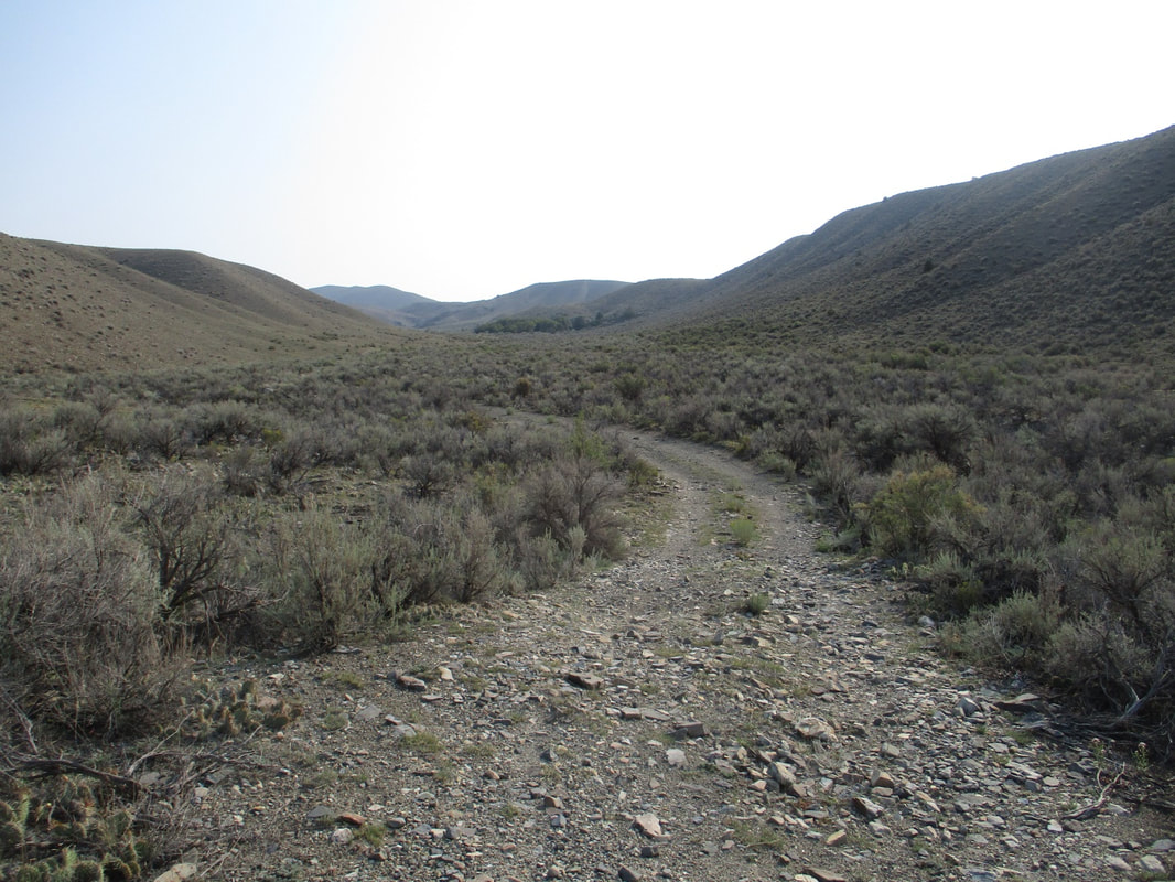
High desert.
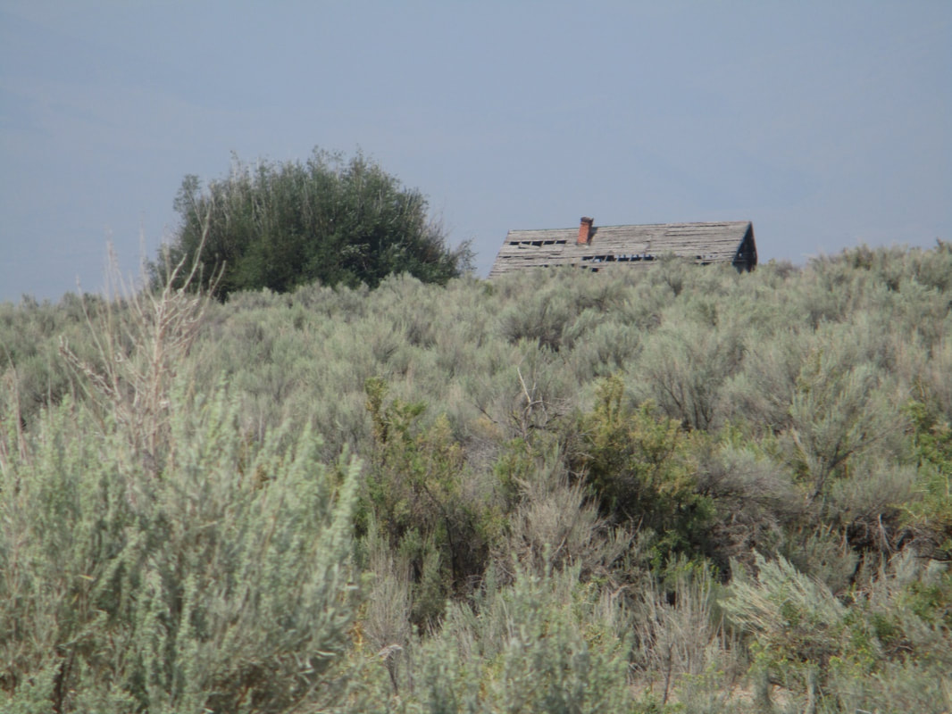
A McKinley-era ranch house lost in the sagebrush.
In the main, though, landscapes are sensitive to much more than mere human history. Volcanic intrusions along the seams of sedimentary rocks in the Montana ranges left deposits of gold, silver, copper and other valuable metal ores, recognizable by their characteristic suites of intruded rocks. Around Dillon the landscape vividly recalls this happening at least twice, in the later Cretaceous and then again in the Eocene.
Many a miner was dry gulched.
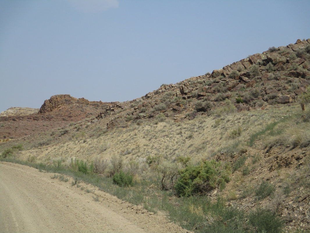
Intrusions.
Lava intrusions were a side effect of the western Montana tectonic train wreck that lifted and displaced gigantic regional chunks and carried them for many miles off to the east, double-stacking the landscape. As the great overthrust progressed, plate subduction drifted farther in the direction we now call west, as new sheets were piled up against the rising Rockies. Even the gap Lewis and Clark used to reach the Pacific Basin is a relic of the old remembered days when the Beaverhead River ran briskly off to the nearest sea, instead of being hoisted up and tilted off towards the far end of a still-growing continent. All the Expedition’s newly renamed rivers were divorced from their original ocean and since remarried. Not the sort of thing a real landscape forgets very easily. It explains a lot, locally and also in general.
NEXT BLOG: ANARCHY IN BANNACK

 RSS Feed