This is part 7 of my series of posts relating the visit my son Alex and I made this past summer to Belgium and Northern France. At the end of my last post we were leaving Châlons and heading toward the village of Marre, 12 km from Verdun.
The sun went down as our GPS sought the location of Marre.
The sun went down as our GPS sought the location of Marre.
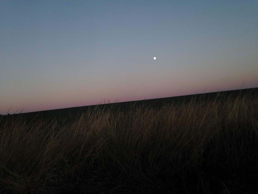
Moonrise Along the Road to Marre. Photo by Gary Mawyer.
Marre is a cluster of 4 or 5 farmhouses. We had reservations at Le Village Gaulois, a strange idiosyncratic hotel somehow re-imagined from the Gallic dark ages. We were too late for dinner but we were welcomed as if we lived there. Le Village Gaulois radiated a rare sense of psychic self-sufficiency. We settled down on the terrace, procured ice, a corkscrew and eau gazeuse, blew out the candle, and reveled in the quiet starlight and the thunderous baying of a pair of 120-lb farm werewolves in the adjacent yard, who could plainly smell foreigners and wanted it known.
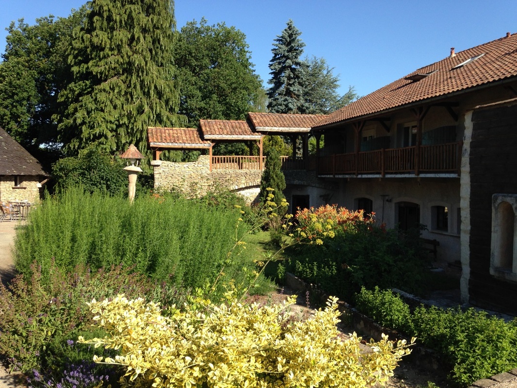
Le Village Gaulois: Five Stars in our book. Photo by Gary Mawyer.
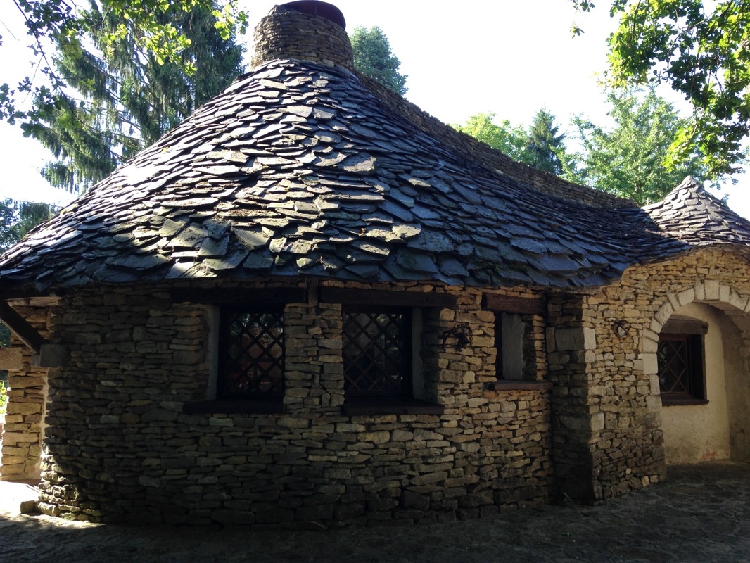
The Restaurant. Photo by Gary Mawyer.
Since it still exists, Marre is not technically one of the many villages detruits, villages that were totally destroyed in the battles for Verdun and never rebuilt. The rebuilt Marre is roughly equidistant from the shattered ruins of the Fort de Marre to the southeast and Le Mort Homme to the northwest, the low hill that saw some of the bitterest fighting of the Great War. Marre is in the middle of the western end of the Verdun battlefield. Today it is a lovely and thinly-populated farm landscape. In September 1916 it was a landscape of ruins from which French artillery managed to defend the line of the Meuse River just to the north.
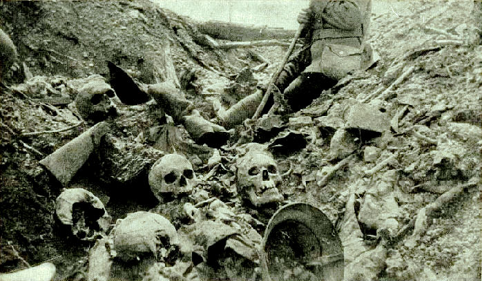
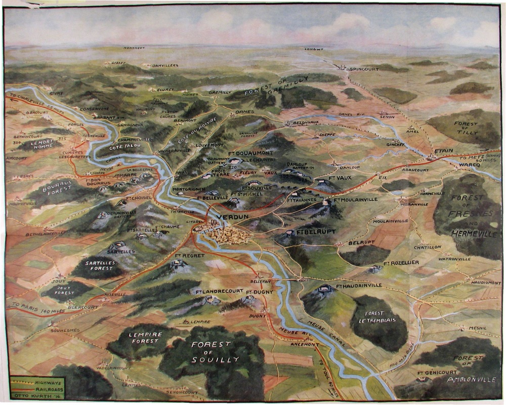
There had never been anything quite like the battle of Verdun. The ancient fortress of Verdun had been modernized over the last quarter of the 19th century to include a vast ring of underground concrete forts, marked on the map below as red pentagons. This massive feat of defensive engineering was designed to make Verdun unassailable. The fortifications, however, did not deter attack. The core battlefield at Verdun, an area of approximately 100 square miles, was quickly reduced to a landscape of overlapping shell craters. The overall battle area totals about 300 square miles, and includes many areas still infested today with unexploded shells and other ammunition, including poison gas shells. Verdun was its own planet. Western history might even be divisible into before Verdun and after, the way Americans see the Civil War. The scale of the disaster at Verdun was quickly obvious to the world at large and came to define the national nightmare of both France and Germany.
There had never been anything quite like the battle of Verdun. The ancient fortress of Verdun had been modernized over the last quarter of the 19th century to include a vast ring of underground concrete forts, marked on the map below as red pentagons. This massive feat of defensive engineering was designed to make Verdun unassailable. The fortifications, however, did not deter attack. The core battlefield at Verdun, an area of approximately 100 square miles, was quickly reduced to a landscape of overlapping shell craters. The overall battle area totals about 300 square miles, and includes many areas still infested today with unexploded shells and other ammunition, including poison gas shells. Verdun was its own planet. Western history might even be divisible into before Verdun and after, the way Americans see the Civil War. The scale of the disaster at Verdun was quickly obvious to the world at large and came to define the national nightmare of both France and Germany.
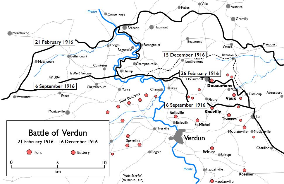
Verdun Map. (Wikipedia).
Our first stop on leaving Le Village Gaulois was the town of Verdun, with its medieval cathedral, which dominates the heights of the area and thus attracted a surfeit of shellfire in the Great War.
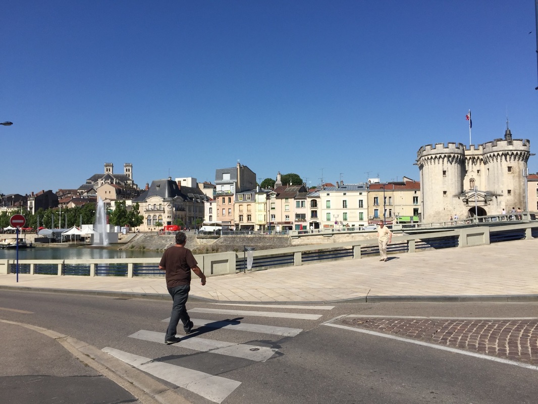
Photo by Alex Mawyer.
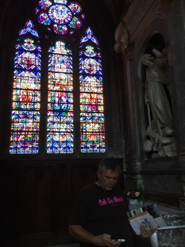
Photo by Alex Mawyer.
The rebuilt cathedral still bears the marks of artillery strikes inside and out.
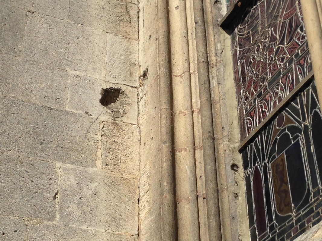
Direct Hit inside the Cloister. Photo by Gary Mawyer.
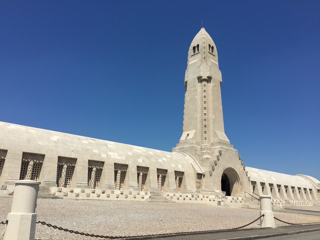
We roamed the hill on foot, particularly enjoying the Tolkienesque victory monument.
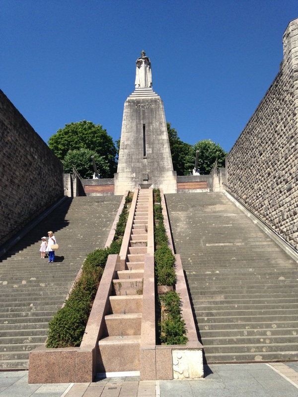
Verdun Memorial Stairs. Photo by Gary Mawyer.
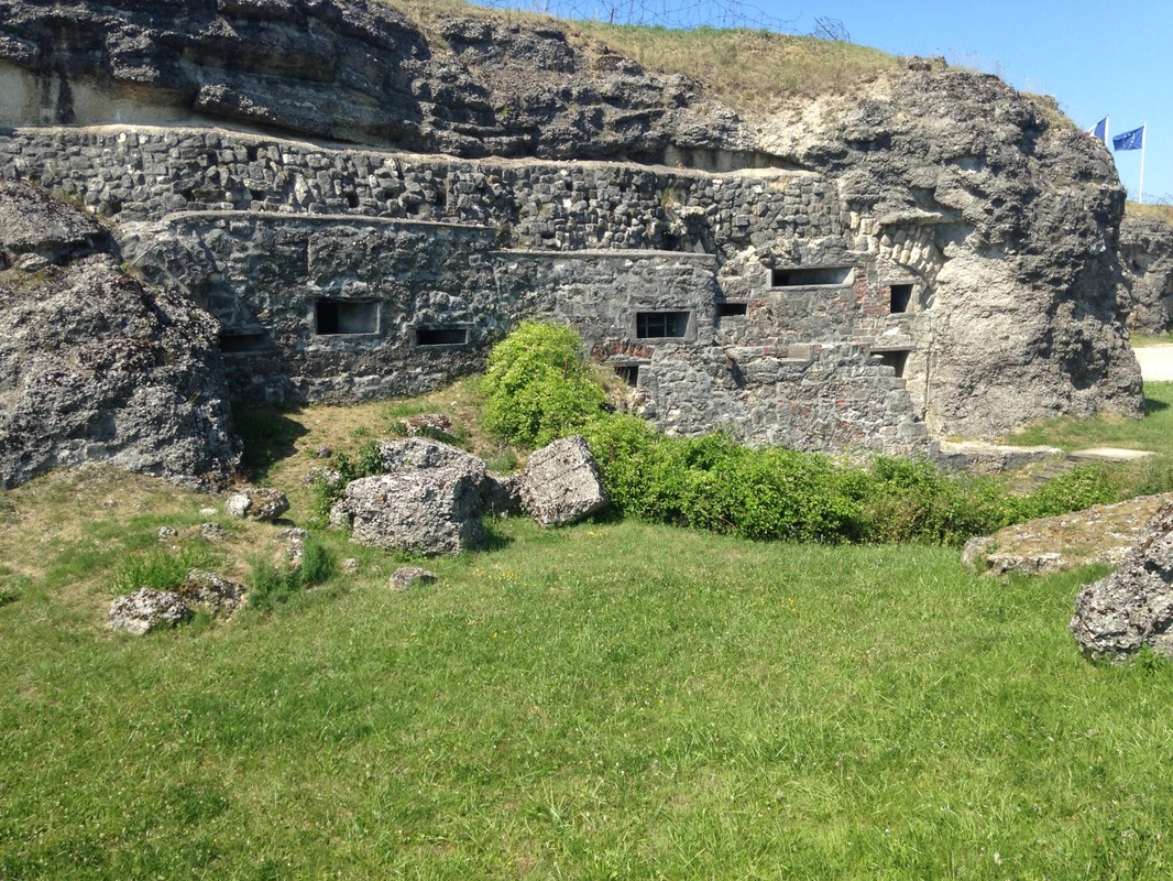
First we saw Fort Vaux. The Verdun forts seem large on top but they are vastly larger underground, like cement icebergs showing only a fraction of their bulk. The builders of the Verdun forts sank vast chthonic edifices many stories deep, from which underground tunnels radiated into the surrounding landscape to create an octopus-like array of turreted gun positions. It is more than slightly creepy, as if the builders already knew life in the open was going to be impossible in the coming war.
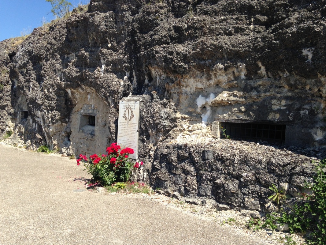
Above: Exterior of Fort Vaux Pretty Much Beat to Rubble. Photo by Gary Mawyer.
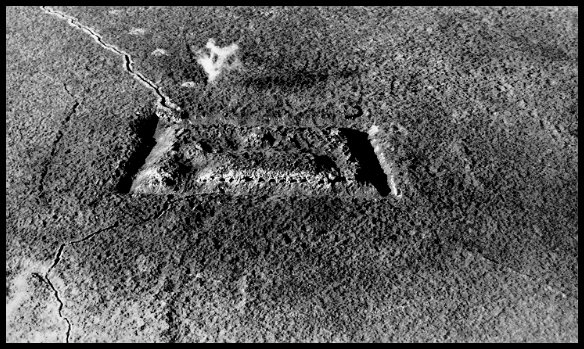
Aerial view of Fort Vaux in November 1916 (Wikimedia).
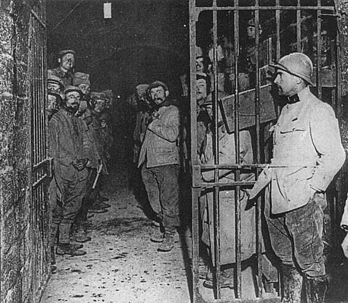
Les Combattants Anciens and Their Environment - Then (Wikipedia).
Outside Fort Vaux in 1917 (Wikipedia).
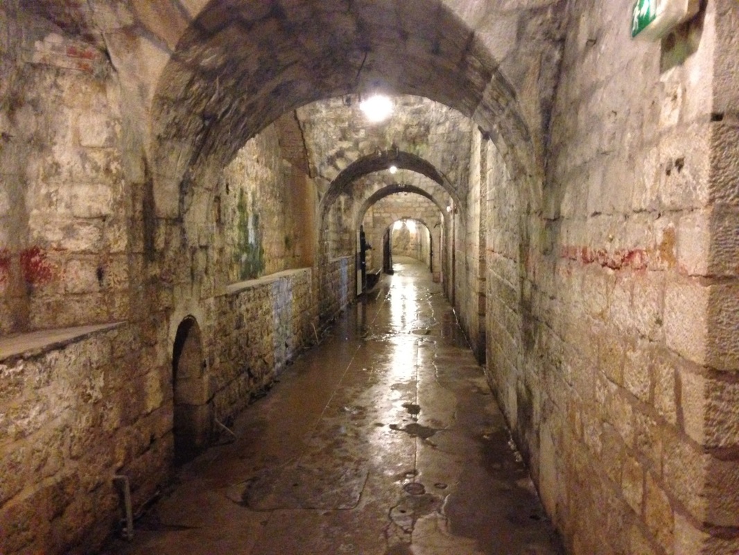
Interior of Fort Vaux Today. Photo by Gary Mawyer.
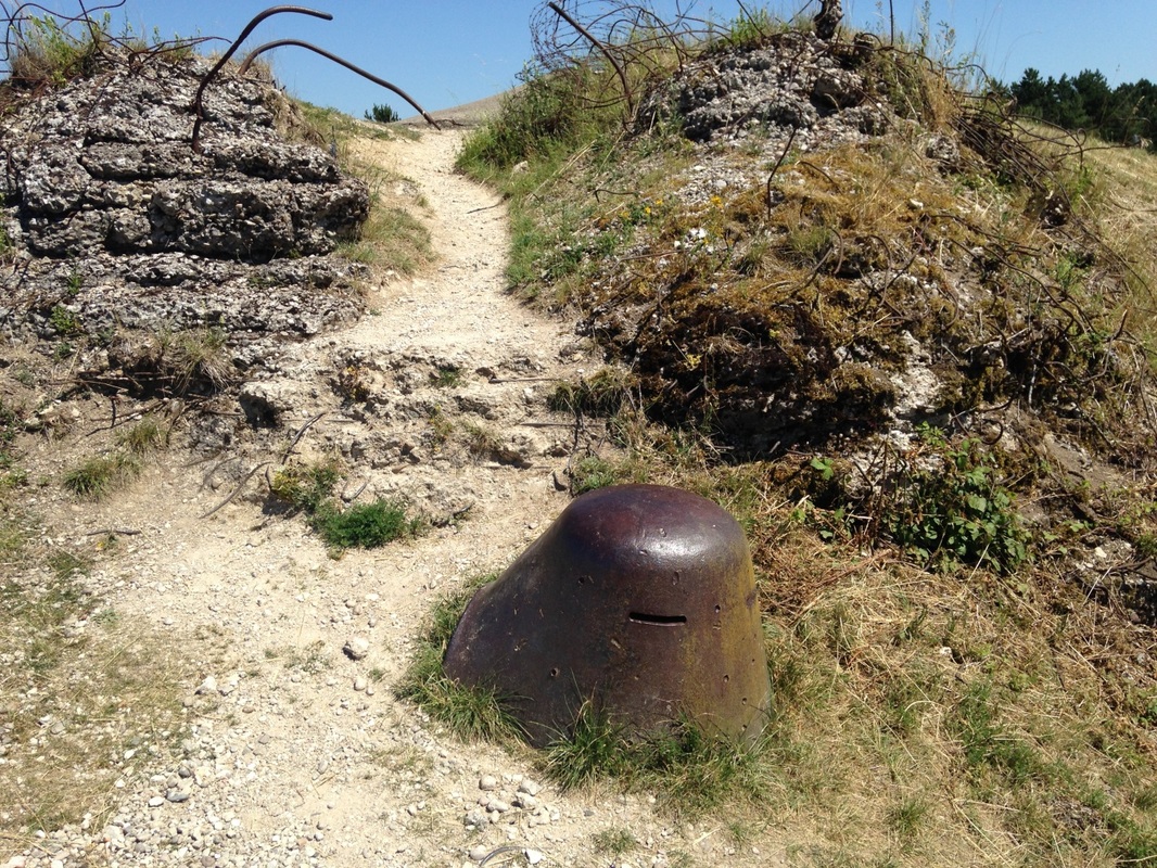
Vaux -- Exterior Observation Turret. Photo by Gary Mawyer.
Vaux -- Machine Gun Position. Photo by Gary Mawyer.
Bits Hither and Yon. Photo by Gary Mawyer.
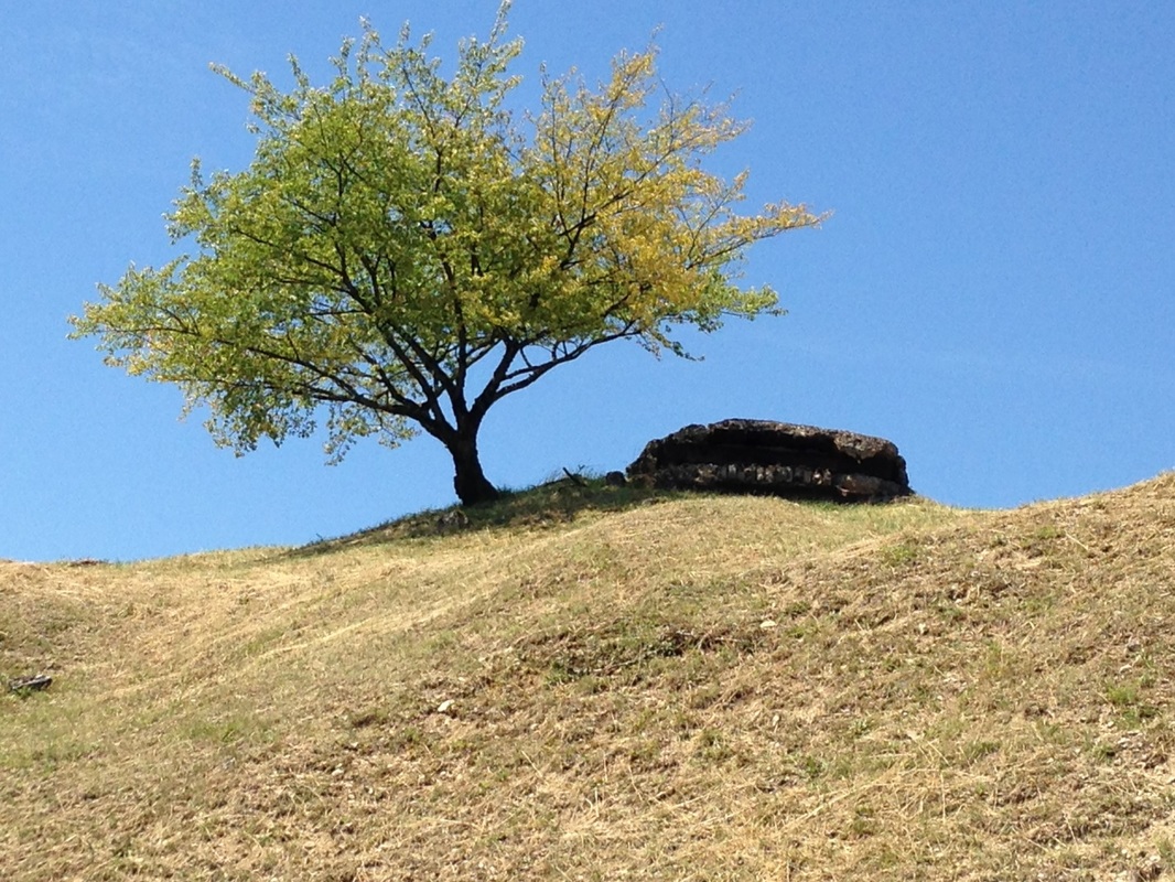
Tree and Bunker. Photo by Gary Mawyer.
We also visited Fort Douamont, the key position in Verdun’s ring of forts.
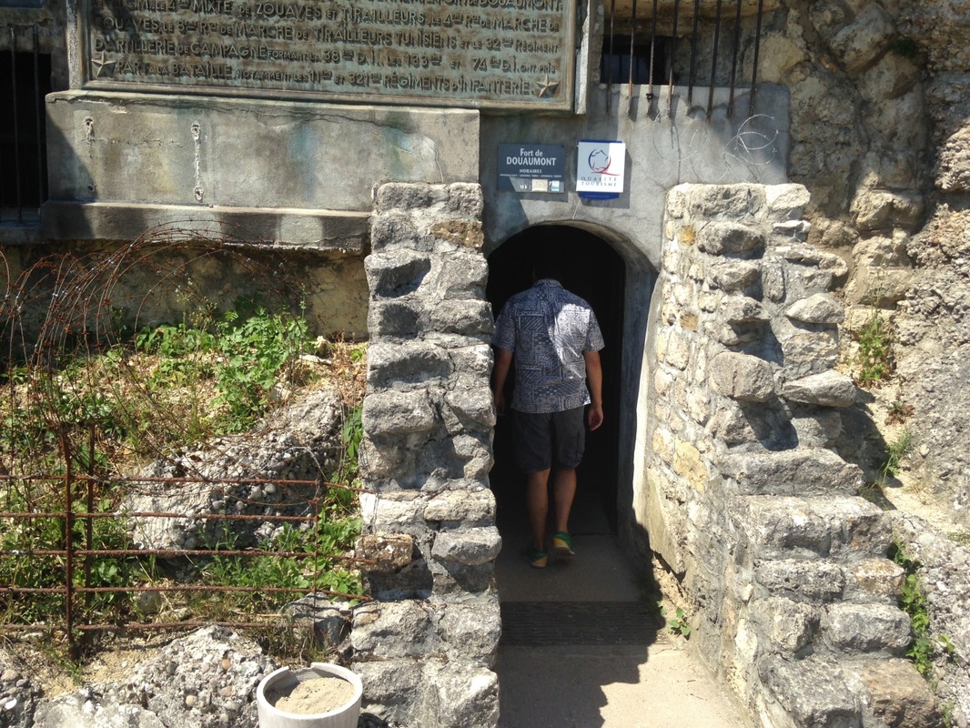
The Entrance to Fort Douamont. Photo by Gary Mawyer.
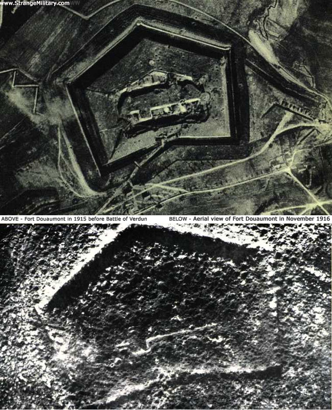
Fort Douamont Before and After (Wikipedia).
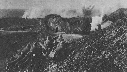
Fort Douamont Under Attack (Wikipedia).
Subterranean Douamont is an eerie labyrinth of tunnels, machinery, and inexplicable pits several stories deep. It was in many respects an underground city, meant to be self-sufficient for months at a time in the event it was attacked.
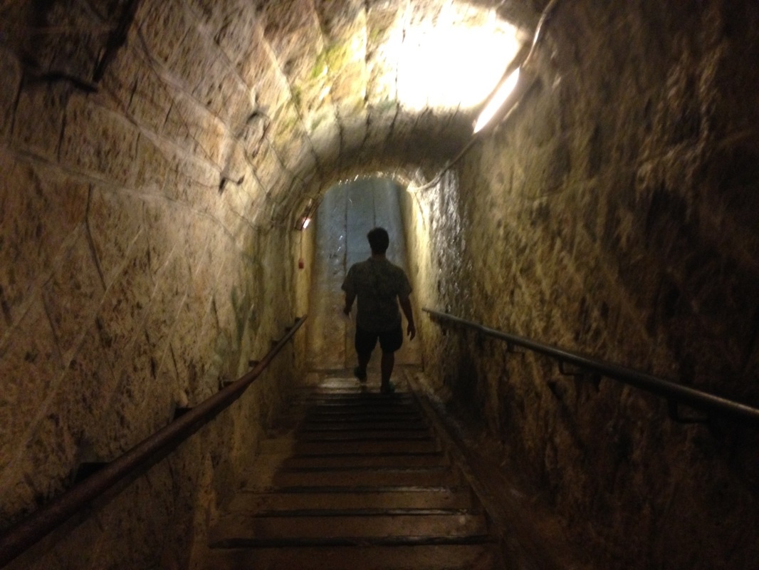
Down another level. Photo by Gary Mawyer.
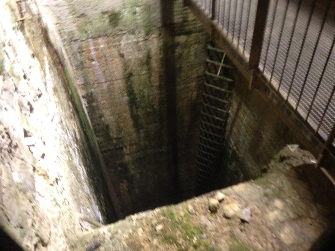
Dropoff to Who Knows Where, Already Three Stories Underground. Photo by Gary Mawyer.
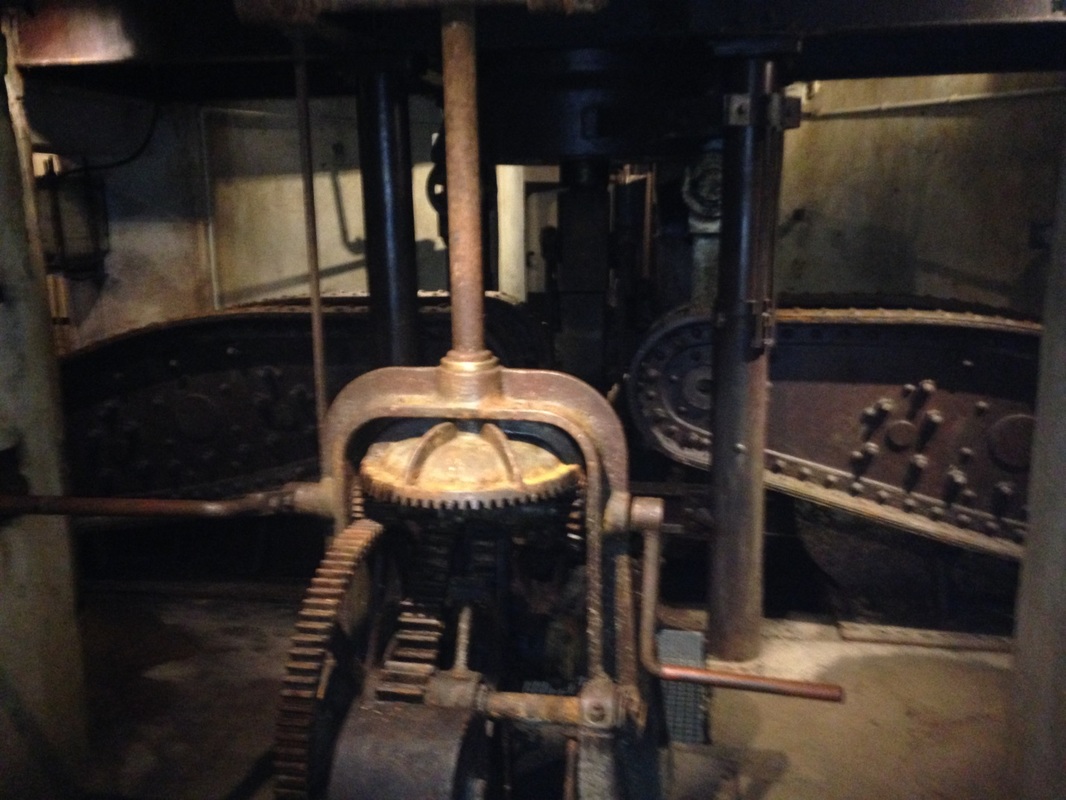
Machinery for Driving the Giant 155 mm Gun Turret. Photo by Gary Mawyer
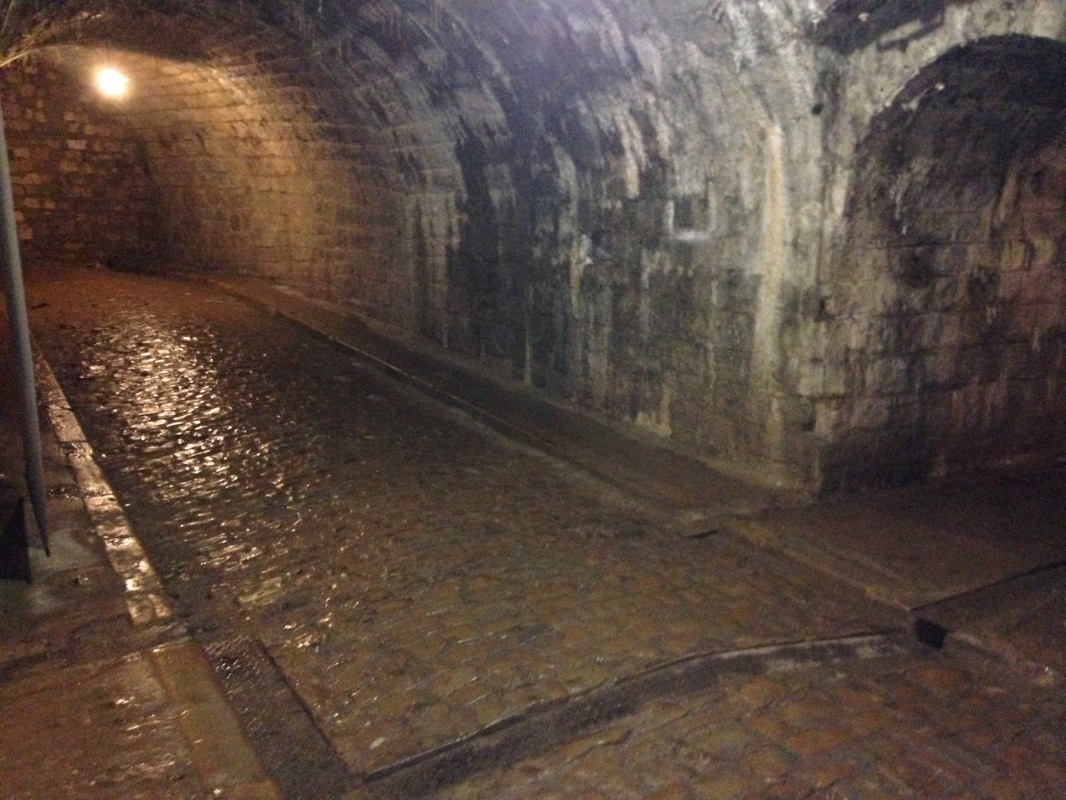
Streets of the Underground City. Photo by Gary Mawyer.
Douamont Exterior. Photo by Gary Mawyer.
On top of the fort. Video by Gary Mawyer.
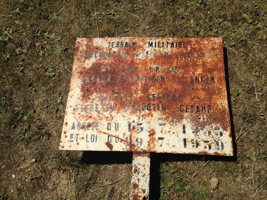
Sign Explaining Where Not to Walk. Photo by Gary Mawyer.
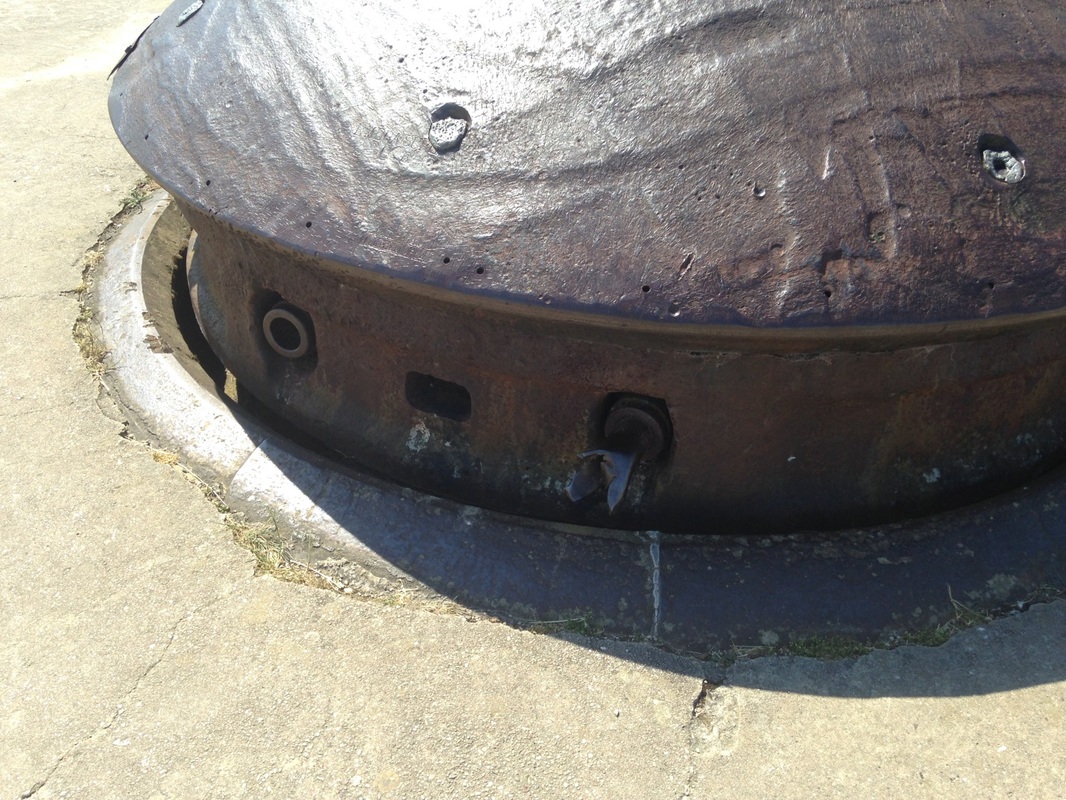
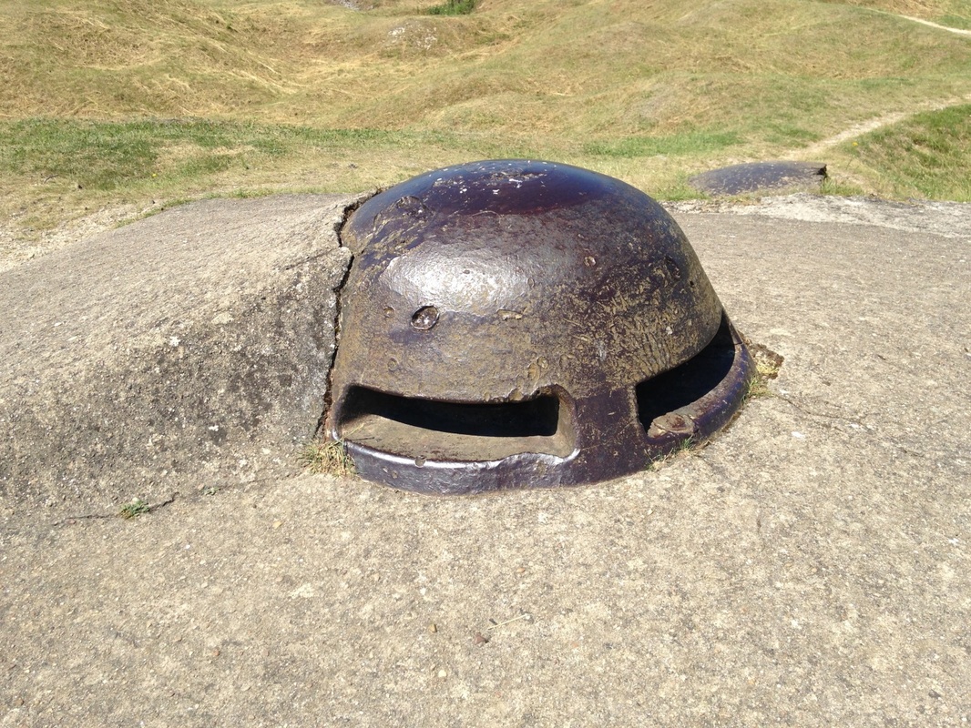
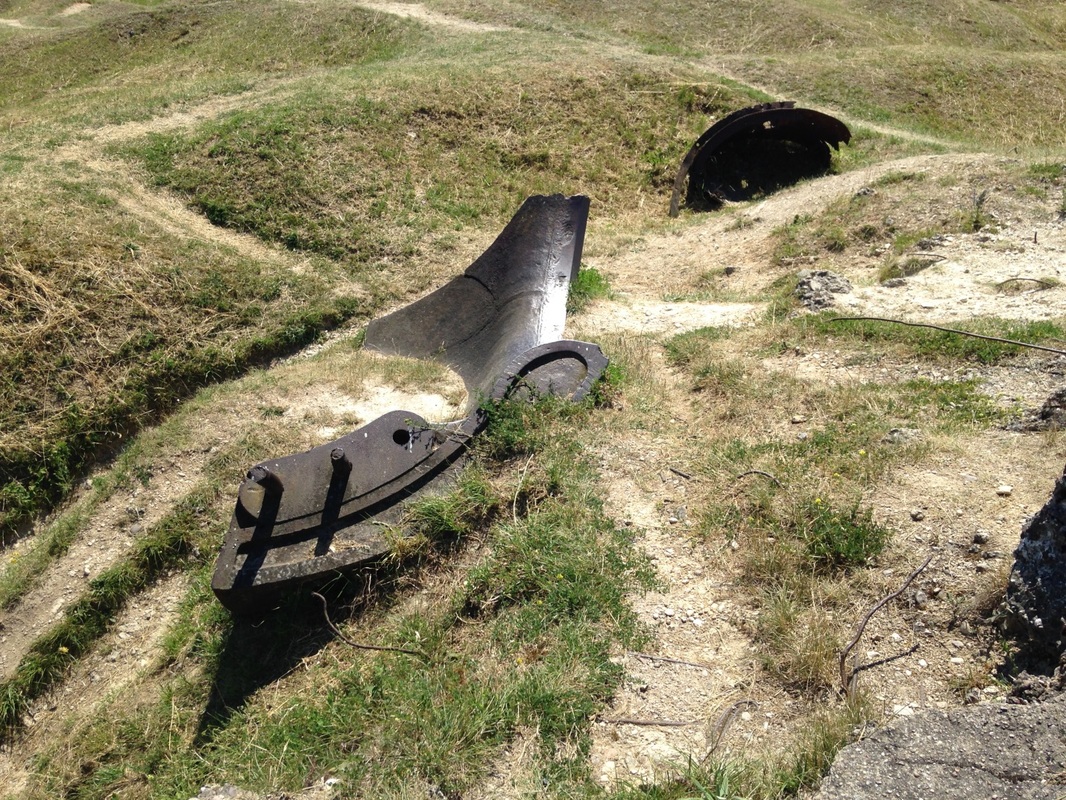
Gun Turret Atop Douamont—One of the Many. Photo by Gary Mawyer.
This housing is scored with direct hits and even contains embedded shell fuses.
The Verdun park has lots of walking trails and back roads and on one of these we found the rear entrance to Fort Souville. After the fall of Forts Vaux and Douamont, Fort Souville and the Fleury ridgeline were for a time the center of the battle, the last obstacle for the German attack.
The Verdun park has lots of walking trails and back roads and on one of these we found the rear entrance to Fort Souville. After the fall of Forts Vaux and Douamont, Fort Souville and the Fleury ridgeline were for a time the center of the battle, the last obstacle for the German attack.
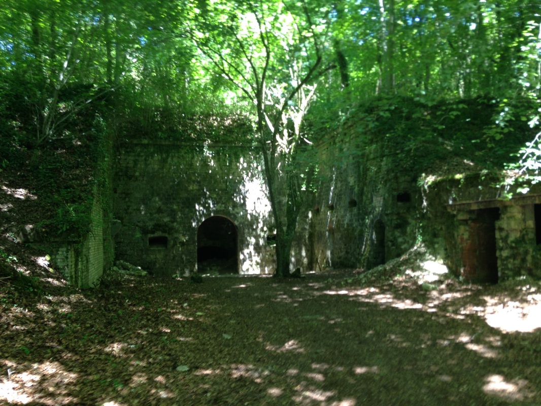
Rear Entrance to Fort Souville. Photo by Gary Mawyer.
Today this leafy enclave is naturally air conditioned by the steady rush of cold air pouring out of the entrance tunnels.
The whole ridge is a tumbled mass of shell holes, trenches and ruins, among which we cautiously ambled for hundreds of yards.
The whole ridge is a tumbled mass of shell holes, trenches and ruins, among which we cautiously ambled for hundreds of yards.
Trench near Fort Souville. Photo by Gary Mawyer.
The attack on Fort Souville included shelling by a 15-inch naval gun mounted on a railway carriage. The pits blasted by this gun are still distinguishable from the smaller shell holes by their depth and size. Souville was brought under direct infantry attack but did not fall.
Landscape view drawn in 1916, not to scale, to show the Verdun area in relief. (Wikipedia.)
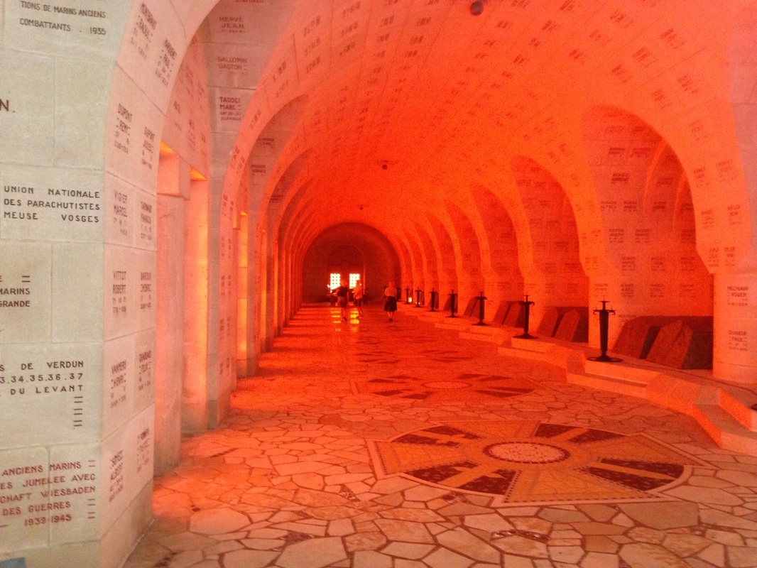
We also visited the Verdun Ossuary, a masterpiece of Art Deco architecture.
Interior of Ossuary. Photo by Gary Mawyer.
An ossuary is a place to store bones. This one has the bones of about a quarter of a million soldiers who died at Verdun, and is adjacent to a vast military cemetery for some tens of thousands of the identified French dead. There are plenty of other cemeteries, some vast, others small, at Verdun, but the ossuary is the gathering spot for the skeletons of the anonymous--be they German, French, Austrian, Moroccan, Senegalese, and others as well. The ossuary is lit with an uncanny red-orange light.
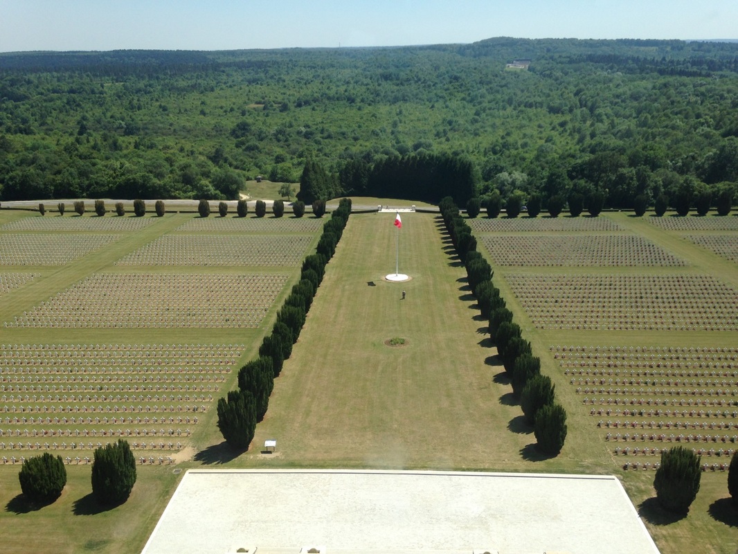
A Glimpse of the French Military Cemetery from the Ossuary Lighthouse. Photo by Gary Mawyer.
Beneath the side corridors of the ossuary are bays in which the bones gathered from the battlefield over the years are heaped. The remains can be viewed through heavy glass windows at ground level. Kneeling and peering in, one sees cairns of bones through each of the many windows. At the ends farthest from the lighthouse the bins are less full, awaiting further finds. There are still tens of thousands of soldiers missing.
The Verdun Ossuary is a natural continuum of the medieval cathedral. While medieval cathedrals display the relics of saints, at Verdun sainthood has been democratized to include everyone. Though mostly French and German, the ossuary draws on all of Europe and the European world empire. Verdun was arguably a violent denial of liberty and fraternity, but equality was finally achieved. There is no central altar, no priestly elite, no liturgy; all were crucified, each in his own way.
At night the Ossuary Lighthouse sweeps the battlefield with its crimson beams as if to summon the angry dead. We did not stay for dark. We returned to Le Village Gaulois for an absolutely astonishing meal.
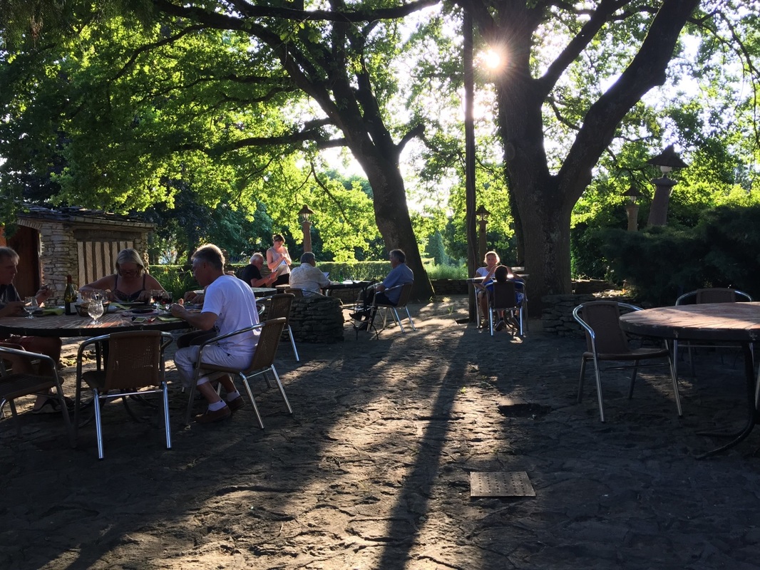
The Dining Terrace. Photo by Alex Mawyer.
It was an opportunity to let our hair stop standing on end, and contemplate life.
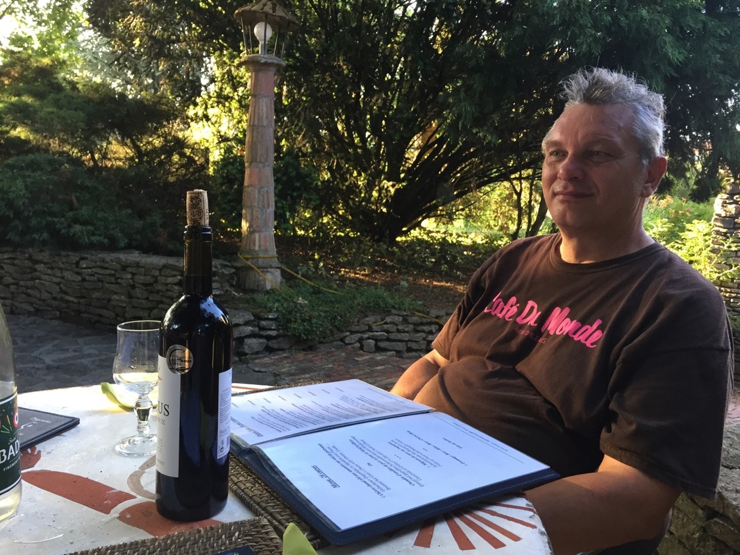
Photo by Alex Mawyer.
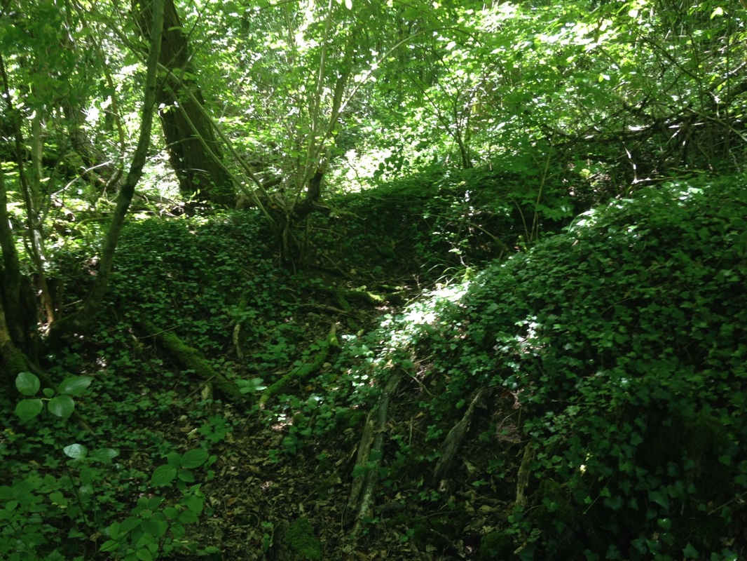
Having dined and wined very satisfactorily, we headed off to the villages detruits of Cumières, in the lee of Le Mort Homme, and Forges, at the western hinge of the 1915 front. At Forges there is signage to help indicate where things were, but there's nothing there now except trees and undergrowth slowly breaking down the shell craters. We found a dirt forest service road up onto the Mort Homme ridge that gave us a sense of the area. This fairly straight road cut through miles of superimposed trench lines from different weeks or months of the battle, riven masses of old trench snaking off in all directions through the pine plantations. As recently as the 1960s nothing but the hardiest weeds could grow on this poisoned ridge, repeatedly saturated with every form of toxic gas and chemical explosive known to either side. The pines were the first successful plantings. Late in the day we reached Le Mort Homme.
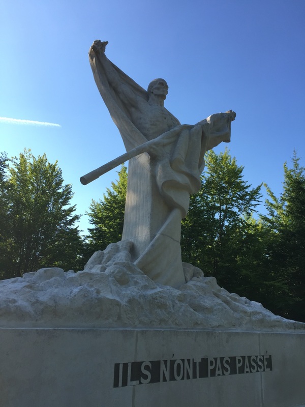
"They did not pass." Photo by Alex Mawyer.
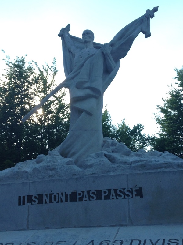
Photo by Gary Mawyer.
In countless assaults, the German army finally seized this ridge, from Forges to Le Mort Homme and Hill 304. In countless counterattacks the French seized it back, at which point the hill may very well have become the most bitterly contested piece of real estate in all of human history. The monument atop it is appropriately nightmarish. The hill itself is a maze of decaying trenches, roots and vines, undergrowth and shell holes, a landscape rearranged by man into an obstacle course, around which we stumbled cautiously until darkness approached.
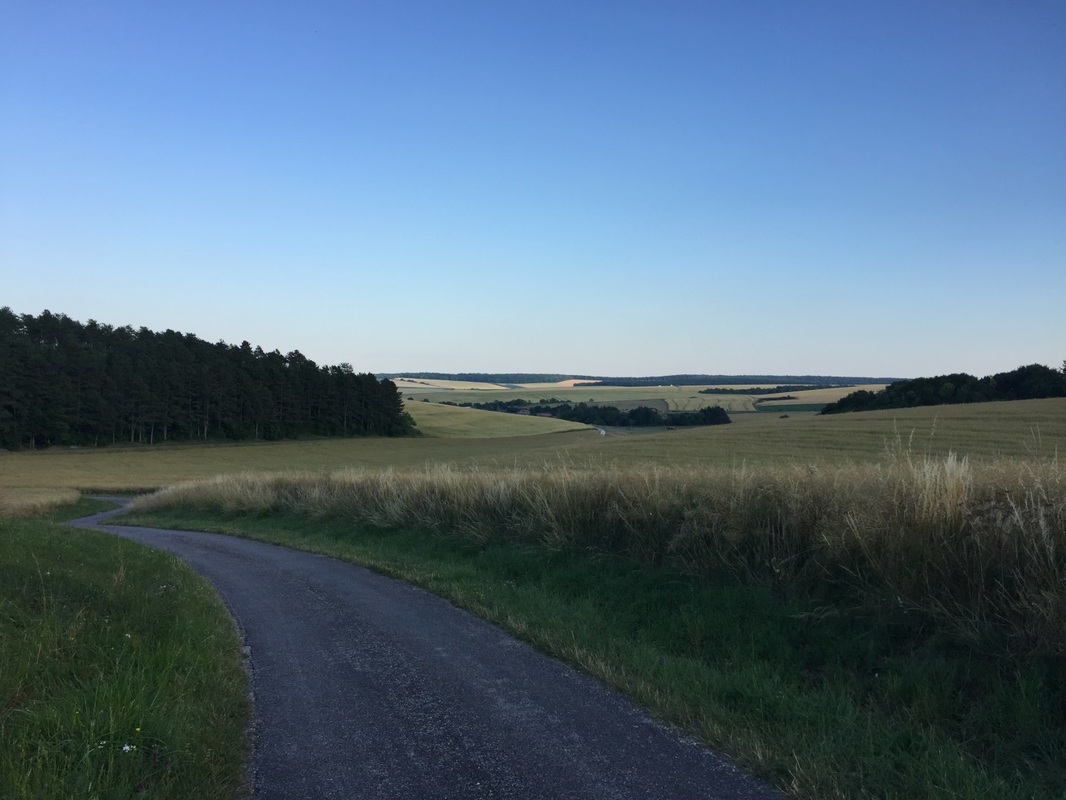
Road from Le Mort Homme to Esnes. Photo by Gary Mawyer.
But it is hard to stay somber for too long in the supernatural beauty of rural France. It’s a lovely country, and we had an appointment with an ice bucket full of champagne and the hilarious farm werewolves back at Le Village Gaulois, who would once again render the night melodious while we quietly discussed deep matters in the starry darkness.

 RSS Feed